Ashfield, New South Wales
Videos
Page
Ashfield is a suburb in the Inner West of Sydney, in the state of New South Wales, Australia. Ashfield is about 8 kilometres west of the Sydney central business district.

Liverpool Road

NASA image of Sydney's CBD and inner west suburbs, with borders of Ashfield shown in orange

Choice Villa Sites, Ashfield, 1876, Watkin and Watkin, lithograph Gibbs Shallard and Co.

Peckham Estate, Ashfield, 1881, Watkin and Watkin
Inner West
Videos
Page
The Inner West of Sydney is an area directly west of the Sydney central business district, New South Wales, Australia. The suburbs that make up the Inner West are predominantly located along the southern shore of Port Jackson, stretching south to the shores of the Cooks River. The western boundary of the Inner West is approximately the A3 arterial road, which divides the Inner West from the Greater Western Sydney region. The Inner West is much larger than the Inner West Council local government area. The Inner West roughly corresponds with the Parish of Petersham and Parish of Concord, two cadastral divisions used for land titles.
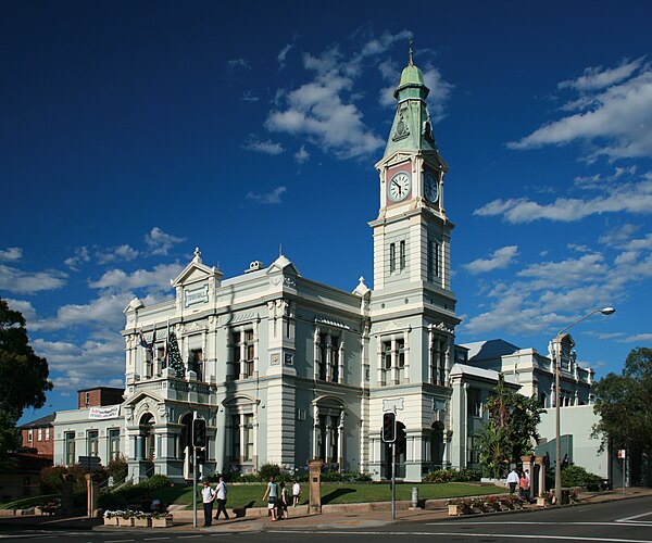
Leichhardt Town Hall, Leichhardt
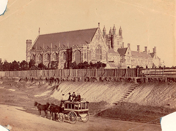
A coach, marked "Ashfield-Burwood", is heading down Parramatta Road towards Sydney in the 1870s (the University of Sydney is in the background).
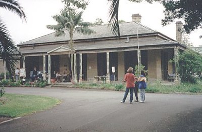
Yasmar, in Haberfield, built in the 1850s.

A large house in the Victorian Italiante style in Strathfield, typical of constructions in this area in the late 19th century.