Chalmette, Louisiana
Videos
Page
Chalmette is a census-designated place (CDP) in, and the parish seat of, St. Bernard Parish in southeastern Louisiana, United States. The 2010 census reported that Chalmette had 16,751 people; 2011 population was listed as 17,119; however, the pre-Katrina population was 32,069 at the 2000 census. At the 2020 U.S. census, its population rebounded to 21,562. Chalmette is part of the New Orleans–Metairie–Kenner metropolitan statistical area. Chalmette is located east of downtown New Orleans and south of Arabi, towards Lake Borgne.

View of Chalmette residential area
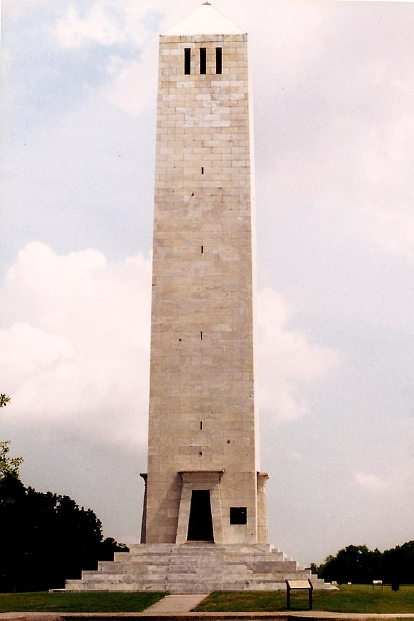
Chalmette Battlefield Monument

Hurricane Katrina: aerial photo of oil spill in Chalmette, showing oil slick on streets (September 2005).
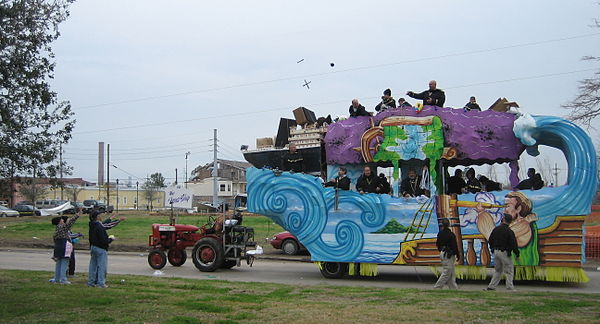
Mardi Gras 2006 in Chalmette: float #10 "The FEMA Ship"
St. Bernard Parish, Louisiana
Videos
Page
St. Bernard Parish is a parish in the U.S. state of Louisiana. The parish seat and largest community is Chalmette. The parish was formed in 1807. St. Bernard Parish is part of the New Orleans–Metairie metropolitan statistical area; the parish is located southeast of the city of New Orleans and comprises the Chandeleur Islands and Chandeleur Sound in the east.
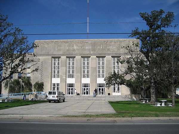
St. Bernard Parish Courthouse

Kenilworth Plantation House (originally Bienvenu) in St. Bernard's Terre aux Boeufs dates back to the 1750s.

"Involuntary Demolition" notice, posted on buildings in St. Bernard Parish when there has been no significant effort to gut, secure, or repair the building over a year after Hurricane Katrina.

Historic place names in St. Bernard Parish