Civic Center, San Francisco
Videos
Page
The Civic Center in San Francisco, California, is an area located a few blocks north of the intersection of Market Street and Van Ness Avenue that contains many of the city's largest government and cultural institutions. It has two large plazas and a number of buildings in classical architectural style. The Bill Graham Civic Auditorium, the United Nations Charter was signed in the Veterans Building's Herbst Theatre in 1945, leading to the creation of the United Nations. It is also where the 1951 Treaty of San Francisco was signed. The San Francisco Civic Center was designated a National Historic Landmark in 1987 and listed in the National Register of Historic Places on October 10, 1978.

Aerial view of Civic Center at dusk in 2016, facing north. San Francisco City Hall is featured in the center.
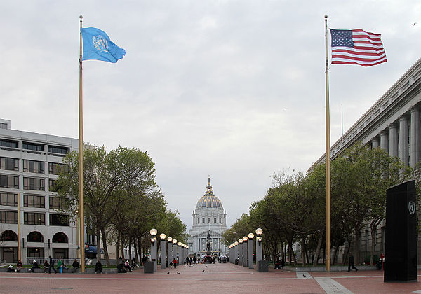
San Francisco Civic Center, looking west along UN Plaza to City Hall

Finalized plan for Civic Center, 1916.

270° panorama.
Market Street (San Francisco)
Videos
Page
Market Street is a major thoroughfare in San Francisco, California. It begins at The Embarcadero in front of the Ferry Building at the northeastern edge of the city and runs southwest through downtown, passing the Civic Center and the Castro District, to the intersection with Portola Drive in the Twin Peaks neighborhood. Beyond this point, the roadway continues into the southwestern quadrant of San Francisco. Portola Drive extends south to the intersection of St. Francis Boulevard and Sloat Boulevard, where it continues as Junipero Serra Boulevard.

Market Street is conspicuous in the view from Twin Peaks.
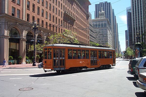
An F Market streetcar turns at the eastern end of Market Street, in front of the Ferry Building.

Market Street, pictured on a postcard, c. 1900. At the near left, the Flood Building at Powell Street. The Emporium is to the right.
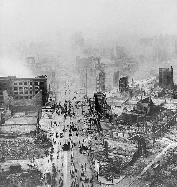
View southwest along Market (1906)