Niagara Falls, Ontario
Videos
Page
Niagara Falls is a city in Ontario, Canada. It is on the western bank of the Niagara River in the Golden Horseshoe region of Southern Ontario, with a population of 94,415 at the 2021 census. It is part of the St. Catharines - Niagara Census Metropolitan Area (CMA). Incorporated on 12 June 1903, the city is across the river from Niagara Falls, New York. The Niagara River flows over Niagara Falls at this location, creating a natural spectacle which attracts millions of tourists each year.
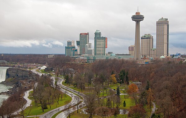
The skyline of Niagara Falls near the edge of the Horseshoe Falls (at left), including the Skylon Tower, the Fallsview Casino, and several high-rise hotels

Coat of arms

R. Nathaniel Dett Chapel, British Methodist Episcopal Church
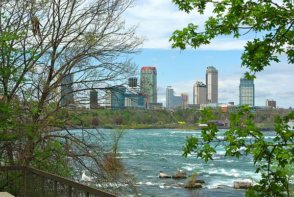
Looking north on the Niagara River towards Niagara Falls, Ontario
Niagara River
Videos
Page
The Niagara River is a river that flows north from Lake Erie to Lake Ontario. It forms part of the border between the province of Ontario in Canada and the state of New York in the United States. There are differing theories as to the origin of the river's name. According to Iroquoian scholar Bruce Trigger, Niagara is derived from the name given to a branch of the locally residing native Neutral Confederacy, who are described as being called the Niagagarega people on several late-17th-century French maps of the area. According to George R. Stewart, it comes from the name of an Iroquois town called Ongniaahra, meaning "point of land cut in two".
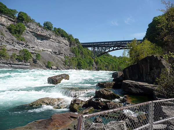
The Niagara River at Niagara Gorge in May 2008

Satellite image of Niagara River flowing north from Lake Erie (bottom) to Lake Ontario (top). The river flows around Grand Island, and then flows over Niagara Falls. It narrows in the Niagara Gorge, where two hydropower reservoirs are visible, and then widens after exiting the gorge. The Welland Canal is visible on the far left.

American Falls with Goat Island to its right

Niagara River at Queenston, Ontario, then known as Queenstown, Upper Canada, c. 1805 watercolour