San Fernando, Trinidad and Tobago
Videos
Page
San Fernando, officially the City of San Fernando, is the most populous city and second most populous municipality in Trinidad and Tobago, after Chaguanas. Sando, as it is known to many local Trinidadians, occupies 19 km2 and is located in the southwestern part of the island of Trinidad. It is bounded to the north by the Guaracara River, the south by the Oropouche River, the east by the Sir Solomon Hochoy Highway, and the west by the Gulf of Paria. The former borough was elevated to the status of a city corporation on 18 November 1988. The motto of San Fernando is: "Sanitas Fortis" - In a Healthy Environment We Will Find Strength. San Fernando is called Trinidad and Tobago's "industrial capital" because of its proximity to the Pointe-à-Pierre oil refinery and many other petrochemical, LNG, iron and steel and aluminium smelters in places such as Point Lisas in Couva, Point Fortin, and La Brea.

Independence Avenue in Downtown San Fernando

San Fernando Hill
Trinidad and Tobago
Videos
Page
Trinidad and Tobago, officially the Republic of Trinidad and Tobago, is the southernmost island country in the Caribbean. Consisting of the main islands Trinidad and Tobago and numerous much smaller islands, it is situated 11 kilometres off the coast of northeastern Venezuela and 130 kilometres south of Grenada. It shares maritime boundaries with Barbados to the east, Grenada to the northwest and Venezuela to the south and west. Trinidad and Tobago is generally considered to be part of the West Indies. The island country's capital is Port of Spain, while its largest and most populous municipality is Chaguanas.

Sir Walter Raleigh raiding Spanish settlement in Trinidad in 1595
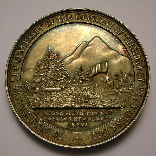
A medallion showing the capture of Trinidad and Tobago by the British in 1797.

Newly arrived indentured Indian labourers in Trinidad and Tobago.

The Queen on 1953 stamps of Trinidad and Tobago