St. Francois County, Missouri
Videos
Page
St. Francois County is a county in the Lead Belt region in the U.S. state of Missouri. At the 2020 census, the population was 66,922. The largest city and county seat is Farmington. The county was officially organized on December 19, 1821. It was named after the St. Francis River. The origin of the river's name is unclear. It may refer to St. Francis of Assisi. Another possibility is that Jacques Marquette, a Jesuit who explored the region in 1673, named the river for the Jesuit missionary Francis Xavier; Marquette had spent some time at the mission of St. François Xavier before his voyage and, as a Jesuit, was unlikely to have given the river a name honoring the Franciscans.

St. Francois County Courthouse in Farmington
Southeast Missouri Lead District
Videos
Page
The Southeast Missouri Lead District, commonly called the Lead Belt, is a lead mining district in the southeastern part of Missouri. Counties in the Lead Belt include Saint Francois, Crawford, Dent, Iron, Madison, Reynolds, and Washington. This mining district is the most important and critical lead producer in the United States.

Historical marker commemorating the first mine at Mine La Motte "about 1700".

Missouri Mines State Historic Site occupies a retired lead mill in the "old lead belt"

Cubic galena (lead ore) from the Sweetwater Mine of the Viburnum Trend (Reynolds County, Missouri).
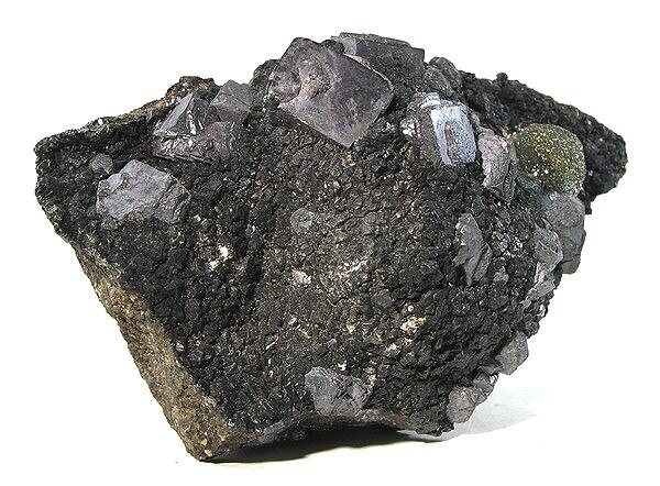
Sphalerite, galena, and marcasite from the Viburnum Trend District (Reynolds County, Missouri).