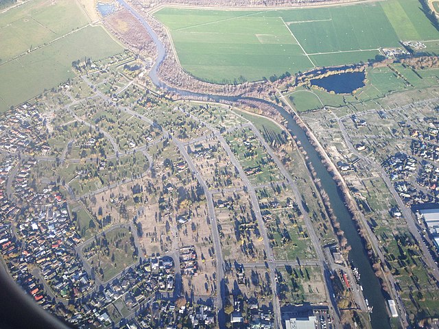
Brooklands is the northernmost suburb of Christchurch, New Zealand. The settlement was built on former swamp land adjacent to Brooklands Lagoon, which forms part of the Waimakariri River mouth. The land damage sustained in the 2010 and 2011 Christchurch earthquakes and subsequent Red Zone classification resulted in the buyout and demolition of nearly all properties in Brooklands, effectively wiping the suburb off the map.
Brooklands just after the 2010 Canterbury earthquake
Damage in Brooklands where buoyancy caused by soil liquefaction pushed up an underground storm drain.
2010 Canterbury earthquake
The 2010 Canterbury earthquake struck the South Island of New Zealand with a moment magnitude of 7.1 at 4:35 am local time on 4 September, and had a maximum perceived intensity of X (Extreme) on the Mercalli intensity scale. Some damaging aftershocks followed the main event, the strongest of which was a magnitude 6.3 shock known as the Christchurch earthquake that occurred nearly six months later on 22 February 2011. Because this aftershock was centred very close to Christchurch, it was much more destructive and resulted in the deaths of 185 people.
Medway footbridge over the Avon River
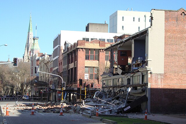
Building damage in Worcester Street, corner Manchester Street, with Christchurch Cathedral in the background
Central Kaiapoi suffered major damage; many of the town's buildings had to be bulldozed as a result of the 2010 earthquake and subsequent quake in February 2011.
The tower of St John's Church, Hororata was badly damaged in the quake, as were many other historic buildings