Deer Park is a neighbourhood in Toronto, Ontario, Canada. It is centered on the intersection of Yonge Street and St. Clair Avenue and its boundaries are the Vale of Avoca section of Rosedale ravine in the east, Farnham Avenue and Jackes Avenue in the south, Avenue Road and Oriole Parkway in the west, the Beltline Trail in the north on the west side of Yonge Street, and Glen Elm Avenue in the north on the east side of Yonge Street. For the purposes of social policy analysis and research, the Toronto government’s Social Development & Administration division includes Deer Park within the City of Toronto's official "Rosedale-Moore Park" and "Yonge-St.Clair" neighbourhood profiles. The neighbourhood is in Ward 22, represented by Councillor Josh Matlow at Toronto City Council.
The view looking south down Yonge Street toward St. Clair Avenue in Deer Park, 2003
Deer Park in 1878. The name of the neighbourhood dates back to 1837, as the name of the Heath family property on the northwest corner of St. Clair Avenue and Yonge Street.
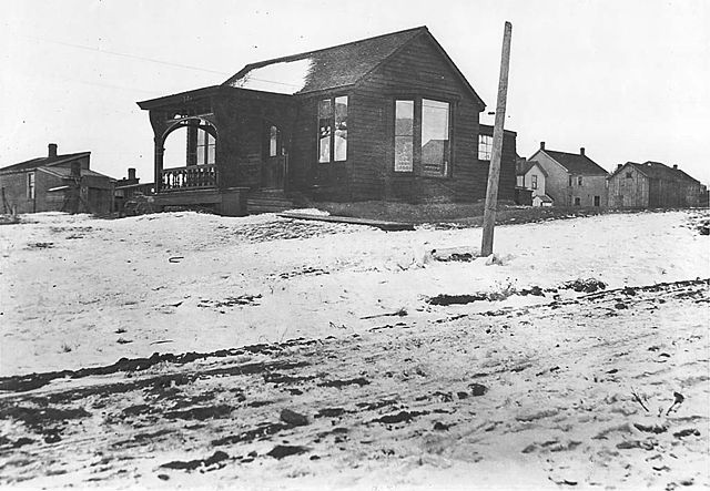
Butcher and grocery store at Deer Park in 1908, the same year the community was annexed by Toronto.
Half of Upper Canada College's main campus is located in Deer Park
St. Clair Avenue is a major east-west street in Toronto, Ontario, Canada. It was laid out in the late 18th century by the British as a concession road, 2 kilometres (1.2 mi) north of Bloor Street and 4 kilometres (2.5 mi) north of Queen Street.
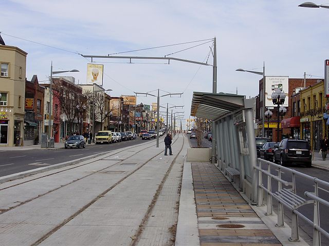
Looking east on St. Clair Avenue West in Corso Italia in 2009 with the nearly completed streetcar right-of-way in centre
The centre lanes of St. Clair Avenue West carry streetcars underground to and from St. Clair West Station.
Looking east on St. Clair Avenue West, near Lansdowne in 2004, before the right-of-way project.