Dumbarton Bridge (California)
The Dumbarton Bridge is the southernmost of the highway bridges across San Francisco Bay in California. Carrying over 70,000 vehicles and about 118 pedestrian and bicycle crossings daily, it is the shortest bridge across San Francisco Bay at 1.63 miles. Its eastern end is in Fremont, near Newark in the San Francisco Bay National Wildlife Refuge, and its western end is in Menlo Park. Bridging State Route 84 across the bay, it has three lanes each way and a separated bike/pedestrian lane along its south side. Like the San Mateo Bridge to the north, power lines parallel the bridge.
The Dumbarton Bridge and its adjacent powerline towers
The original vertical-lift span of the Dumbarton Bridge, shown in 1984 shortly before it was demolished
A view from the air, above Palo Alto, looking towards Fremont
Dumbarton Rail Bridge in 2007, as seen from a kayak
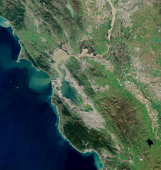
San Francisco Bay is a large tidal estuary in the U.S. state of California, and gives its name to the San Francisco Bay Area. It is dominated by the cities of San Francisco, San Jose, and Oakland.
San Francisco Bay
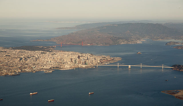
Aerial panorama of the northern Bay, the Bay Bridge, Golden Gate, and Marin Headlands on a clear morning. November 2014 photo by Doc Searls.
Panorama of San Francisco Bay, and the city skyline seen from Marin County in the Golden Gate National Recreation Area
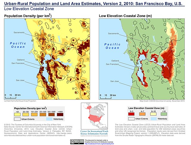
Population density and low elevation coastal zones in San Francisco Bay (2010). The San Francisco Bay is especially vulnerable to sea level rise.


