Harpers Ferry, West Virginia
Videos
Page
Harpers Ferry is a historic town in Jefferson County, West Virginia, in the lower Shenandoah Valley. The town's population was 269 at the 2020 United States census. Situated at the confluence of the Potomac and Shenandoah rivers, where Maryland, Virginia, and West Virginia meet, it is the easternmost town in West Virginia.

Aerial view of Harpers Ferry from Maryland Heights at the confluence of the Shenandoah (left) and Potomac rivers
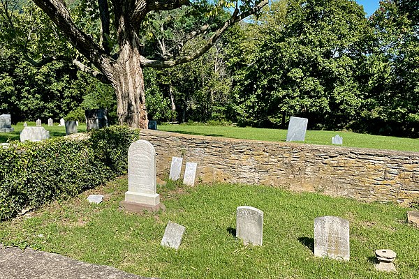
Gravesite of Robert Harper from whom the town takes its name

View of Harpers Ferry from Jefferson Rock in 1854

The same view in 2021
Jefferson County, West Virginia
Videos
Page
Jefferson County is located in the Shenandoah Valley in the Eastern Panhandle of West Virginia. It is the easternmost county of the U.S. state of West Virginia. As of the 2020 census, the population was 57,701. Its county seat is Charles Town. The county was founded in 1801, and today is part of the Washington metropolitan area.

Jefferson County Courthouse in Charles Town

Coverage of John Brown's raid in Frank Leslie's illustrated newspaper, v. 8, no. 205 (November 5, 1859), p. 359

Tripoint of Virginia, West Virginia, and Maryland in the Potomac River region of Harper's Ferry, the lowest point in West Virginia

US 340 and WV Route 9 run concurrently for a few miles in Charles Town