Michoud is an area in Eastern New Orleans, part of the Ninth Ward of New Orleans, Louisiana, located at latitude 30.03°N, longitude −89.925°W.
Old plantation smokestacks stand outside the administration offices of NASA's Michoud Assembly Facility, c.2006.
New Orleans East is the eastern section of New Orleans, Louisiana, the newest section of the city. This collection neighborhood sub divisions represents 65% of the city's total land area, but it is geographically isolated from the rest of the city by the Inner Harbor Navigational Canal. It is surrounded by water on all sides, bounded by the Industrial Canal, Gulf Intracoastal Waterway, Lake Pontchartrain, Lake Borgne, and the Rigolets, a long deep-water strait connecting the two lakes. Interstate 10 (I-10) splits the area nearly in half, and Chef Menteur Hwy, Downman Rd, Crowder Blvd, Dwyer Rd, Lake Forest Blvd, Read Blvd, Bullard Ave, Michoud Blvd, Hayne Blvd, Morrison Rd, Bundy Rd, and Almonaster Ave serve as major streets and corridors.
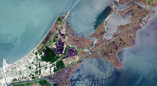
A Landsat view of New Orleans East. Note that dense development occurs exclusively in the western portion of eastern New Orleans; the remaining land is largely undeveloped swamp and marsh.
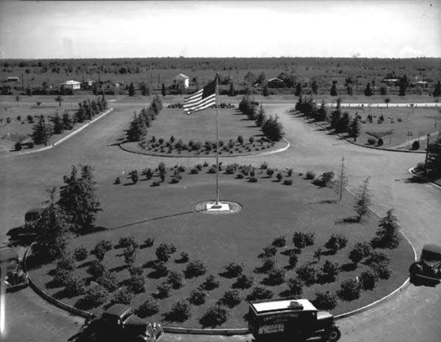
View from the tower of Shushan (now Lakefront) Airport, 1937, showing a few houses along Hayne Boulevard and mostly empty fields further south.
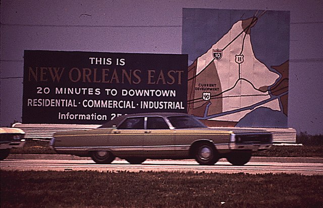
Billboard promoting the eastern New Orleans "New Town" development, 1972. Note the darker-toned 'Current Development' portion, encompassing present-day Village de L'Est and Oak Island, as well as Venetian Isles and a sliver of Irish Bayou. The light-toned portion is mostly today's Bayou Sauvage National Wildlife Refuge
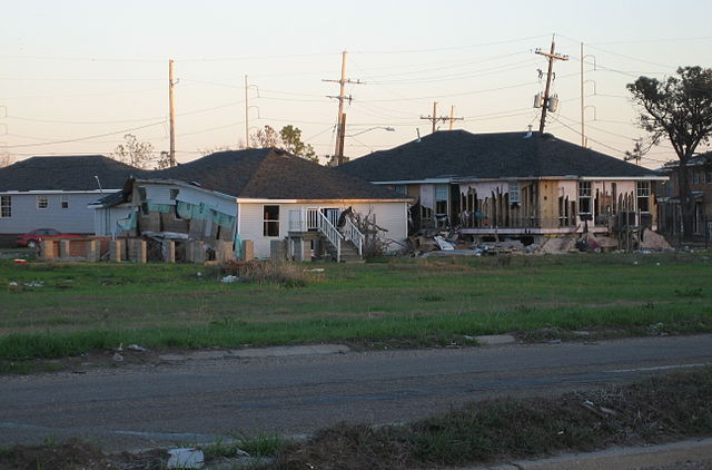
Damaged houses in eastern New Orleans after Katrina