Pico da Neblina is the highest peak in Brazil, 2,995.3 metres (9,827 ft) above sea level, in the Serra da Neblina, part of the Serra do Imeri, a section of the Guiana Highlands on the Brazil-Venezuela border. As determined by a border survey expedition in 1962, its summit lies just within Brazilian territory, at a horizontal distance of only 687 m (2,254 ft) from the Venezuelan border at Pico 31 de Março. It is a common misconception to refer to this mountain as the highest point in South America outside the Andes while ignoring the Sierra Nevada de Santa Marta in Colombia.
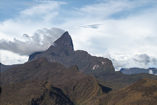
Pico da Neblina in 2015, with the usual clouds.
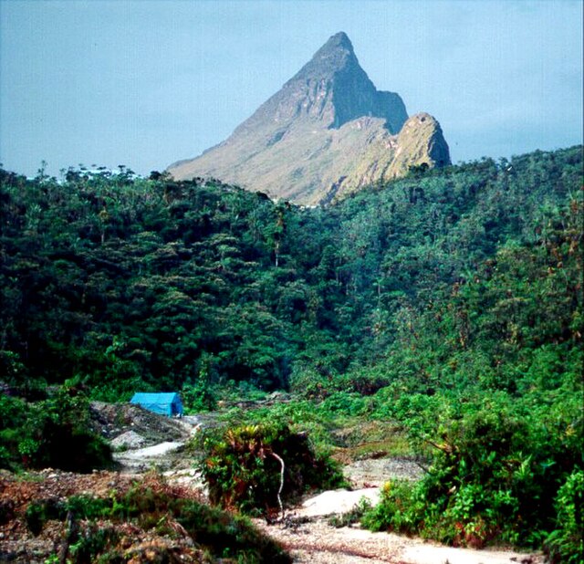
Pico da Neblina in 1998 seen from the distance, without the usual clouds. The round blue-shaded secondary peak just behind it is Pico 31 de Março.
The Guiana Shield is one of the three cratons of the South American Plate. It is a 1.7 billion-year-old Precambrian geological formation in northeast South America that forms a portion of the northern coast. The higher elevations on the shield are called the Guiana Highlands, which is where the table-like mountains called tepuis are found. The Guiana Highlands are also the source of some of the world's most well-known waterfalls such as Angel Falls, Kaieteur Falls and Cuquenan Falls.
Cerros de Mavecure, Guainía department, Colombia
Devil's Canyon in the Canaima National Park, Venezuela
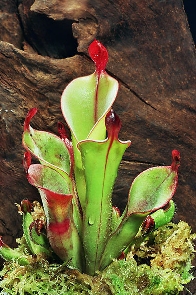
Heliamphora chimantensis, endemic to the Chimantá Massif (a Venezuelan part of the Guiana Shield)