U.S. Route 40 Alternate (Keysers Ridge–Cumberland, Maryland)
Videos
Page
U.S. Route 40 Alternate is the U.S. Highway designation for a former segment of U.S. Route 40 (US 40) through Garrett and Allegany counties in Maryland. The highway begins at US 40 near exit 14 on Interstate 68 (I-68) and runs 31.80 miles (51.18 km) eastward to Cumberland, where it ends at exit 44 on I-68. Alt US 40 is maintained by the Maryland State Highway Administration (MDSHA).

US 40 Alt westbound just west of MD 546 near Finzel

US 40 Alt eastbound past MD 495 in Grantsville
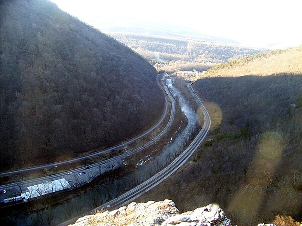
Alt US 40 passing through the Narrows in Cumberland

View west from the east end of US 40 Alt. at I-68/US 40/US 220 in Cumberland
U.S. Route 40 in Maryland
Videos
Page
U.S. Route 40 in the U.S. state of Maryland runs from Garrett County in Western Maryland to Cecil County in the state's northeastern corner. With a total length of 221 miles (356 km), it is the longest numbered highway in Maryland. Almost half of the road overlaps or parallels with Interstate 68 (I-68) or I-70, while the old alignment is generally known as US 40 Alternate, US 40 Scenic, or Maryland Route 144. West of Baltimore, in the Piedmont and
Appalachian Mountains / Blue Ridge region of the Western Maryland panhandle of the small state, the portions where it does not overlap an Interstate highway are mostly two-lane roads. The portion northeast of Baltimore going toward Wilmington in northern Delaware and Philadelphia in southeastern Pennsylvania is a four-lane divided highway, known as the Pulaski Highway. This section crosses the Susquehanna River at the north end of the Chesapeake Bay on the Thomas J. Hatem Memorial Bridge.

US 40 eastbound past the Pennsylvania state line in Garrett County
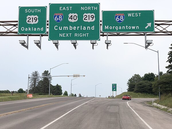
US 40 eastbound at I-68 and US 219 in Keysers Ridge
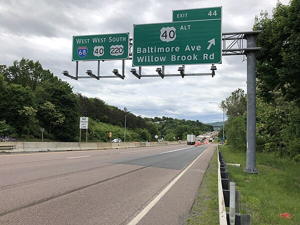
I-68/US 40/US 220 concurrency in Cumberland
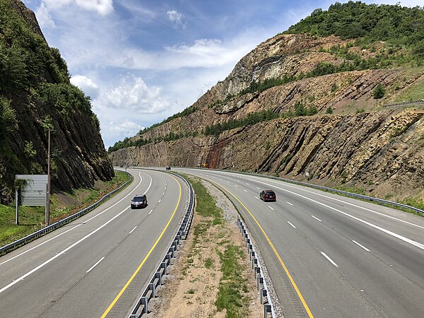
A 340-foot (100 m) deep cut in Sideling Hill makes room for the I-68/US 40 roadway