2010 Chile earthquake
Videos
Page
The 2010 Chile earthquake and tsunami occurred off the coast of central Chile on Saturday, 27 February at 03:34:12 local time, having a magnitude of 8.8 on the moment magnitude scale, with intense shaking lasting for about three minutes. It was felt strongly in six Chilean regions that together make up about 80 percent of the country's population. According to the United States Geological Survey (USGS) the cities experiencing the strongest shaking—VIII (Severe) on the Mercalli intensity scale (MM)—were Concepción, Arauco, and Coronel. According to Chile's Seismological Service, Concepción experienced the strongest shaking at MM IX (Violent). The earthquake was felt in the capital Santiago at MM VII or MM VIII. Tremors were felt in many Argentine cities, including Buenos Aires, Córdoba, Mendoza, and La Rioja. Tremors were felt as far north as the city of Ica in southern Peru. It is the largest earthquake to hit Chile since the 1960 Valdivia earthquake.

Damage sustained by a building in Concepción, located around 100 kilometres south of the epicenter.

The partially collapsed 21-story O'Higgins Tower, Concepción

House thrown into the streets of Pelluhue after the tsunami

A severely damaged building in Maipú, Santiago
Concepción, Chile
Videos
Page
Concepción is a city and commune in south-central Chile, and the geographical and demographic core of the Greater Concepción metropolitan area, one of the three major conurbations in the country. It has a significant impact on domestic trade being part of the most heavily industrialized region in the country. It is the seat of the Concepción Province and the capital of the Bío Bío Region. It sits about 500 km south of the nation's capital, Santiago.

Image: Concepcion Centro
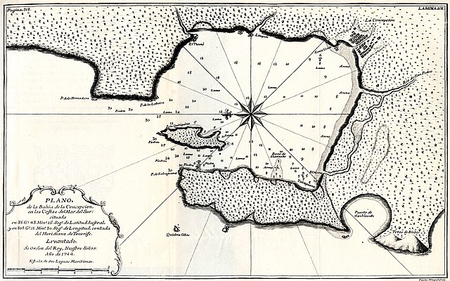
Plan from 1744 showing the Bay of Concepción before the 1751 earthquake

Clothing of the inhabitants of Concepción in the early 19th century
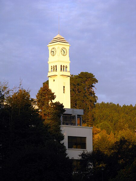
The campanile of the Universidad de Concepción