2010 Haiti earthquake
Videos
Page
The 2010 Haiti earthquake was a catastrophic magnitude 7.0 Mw earthquake that struck Haiti at 16:53 local time on Tuesday, 12 January 2010. The epicenter was near the town of Léogâne, Ouest department, approximately 25 kilometres (16 mi) west of Port-au-Prince, Haiti's capital.

The heavily damaged National Palace of Haiti after the earthquake
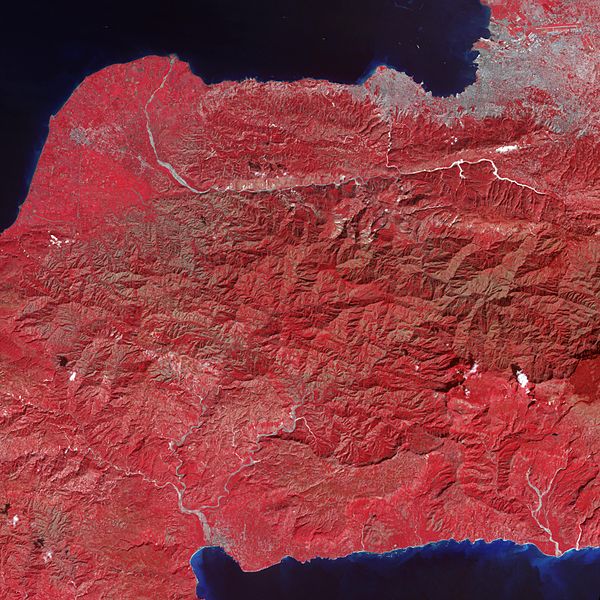
Tiny dots of white against the plant-covered landscape (red in this image) are possible landslides, a common occurrence in mountainous terrain after large earthquakes. The Enriquillo-Plantain Garden fault zone runs along the two linear valleys at the top of the image.
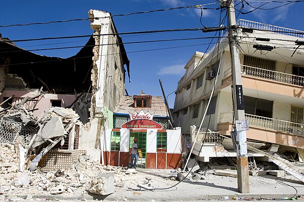
Damaged buildings in Port-au-Prince
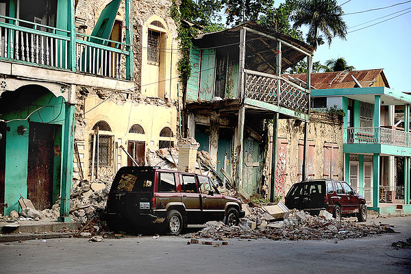
Damaged buildings in Jacmel
Haiti
Videos
Page
Haiti, officially the Republic of Haiti, is a country on the island of Hispaniola in the Caribbean Sea, east of Cuba and Jamaica, and south of The Bahamas. It occupies the western three-eighths of the island which it shares with the Dominican Republic. Haiti is 27,750 km2 (10,714 sq mi), the third largest country in the Caribbean, and has an estimated population of 11.4 million, making it the most populous Caribbean country. The capital is Port-au-Prince.

Artist's impression of Christopher Columbus landing on Hispaniola, engraving by Theodor de Bry
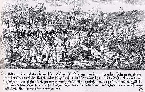
Saint-Domingue slave revolt in 1791

General Toussaint Louverture

Battle between Polish troops in French service and the Haitian rebels. The majority of Polish soldiers eventually deserted the French army and fought alongside the Haitians.