The Agulhas Bank is a broad, shallow part of the southern African continental shelf which extends up to 250 km (160 mi) south of Cape Agulhas before falling steeply to the abyssal plain.
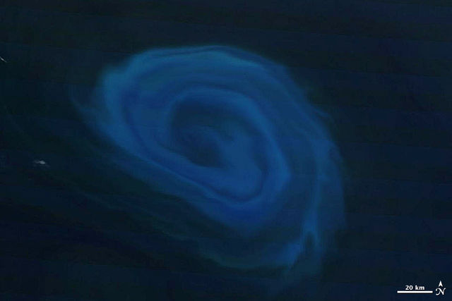
Light blue plankton in a 150 km (93 mi) wide anti-cyclonic (counter-clockwise) Agulhas ring, 800 km (500 mi) off the coast of South Africa. Such eddies, among the largest in the world, are peeled off the Agulhas Current on the eastern edge of the Agulhas Bank.
Juvenile Cape knifejaw and kelp forest at Alphard Banks
Dalgleish sea fan at Dalgleish Bank
The Agulhas Bank relative to the Agulhas Ridge, Basin, and Plateau
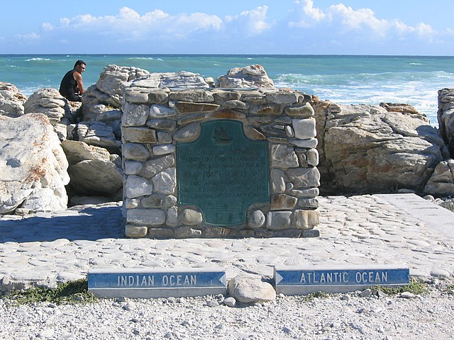
Cape Agulhas is a rocky headland in Western Cape, South Africa. It is the geographic southern tip of Africa and the beginning of the traditional dividing line between the Atlantic and Indian Oceans according to the International Hydrographic Organization. It is approximately half a degree of latitude, or 55 kilometres (34 mi), further south than the Cape of Good Hope.
A marker at Cape Agulhas indicates the official dividing line between the Atlantic and Indian oceans.
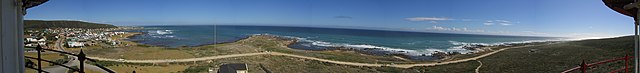
Panorama from the lighthouse around the cape
The lighthouse at Cape Agulhas has guided many ships around the cape over the years.