Altai Krai
Videos
Page
Altai Krai is a federal subject of Russia. It borders clockwise from the west, Kazakhstan, Novosibirsk and Kemerovo Oblasts, and the Altai Republic. The krai's administrative centre is the city of Barnaul. As of the 2021 Census, the population of the krai was 2,163,693.

Ob Plateau, Altai Krai. The east–west "spikes" are ravines in the surface of the area; they lie slightly lower than the surrounding, lighter-toned agricultural lands. The dark zones are forested with pines and dotted with salt-rich lakes. The image shows a distance of a little more than 300 km (190 mi) from left to right, and the forested spikes are nearly that length. Barnaul is at center right, on the Ob River.

Devil Mountain, Altaysky District
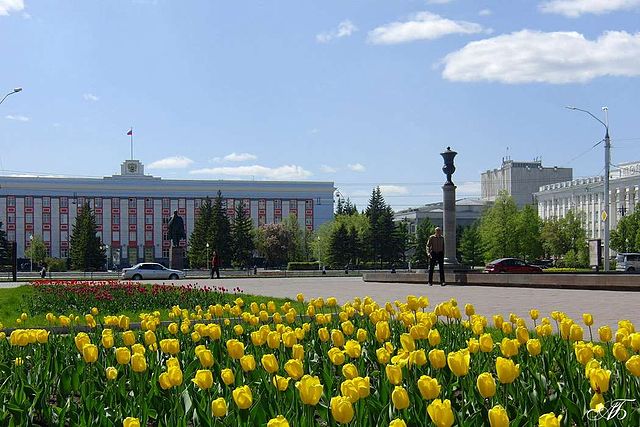
Krai Administration seat in the Soviets Square, Barnaul

Cathedral of the Protection of the Theotokos in Barnaul, Altai Krai
East Kazakhstan Region
Videos
Page
East Kazakhstan Region is a region of Kazakhstan. It occupies the easternmost part of Kazakhstan, and includes parts of the Irtysh River, Lake Markakol, and Lake Zaysan. Its administrative center is Öskemen. The region borders Altai Krai and Altai republic in Russia in the north and northeast and the People's Republic of China, via Xinjiang, in the south and southeast. The easternmost point of the Oblast is within about 50 kilometres of the westernmost tip of Mongolia; however, Kazakhstan and Mongolia do not share a common border, the two countries being separated by a small part of Russia and China.

Image: Kazakhstan Altay 2

Image: Bukhtarma

Image: Yazevoe ozero gora Belukha 2
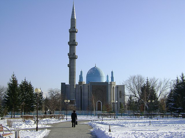
Mosque in Öskemen