Amazonis quadrangle
Videos
Page
The Amazonis quadrangle is one of a series of 30 quadrangle maps of Mars used by the United States Geological Survey (USGS) Astrogeology Research Program. The Amazonis quadrangle is also referred to as MC-8.

Image of the Amazonis Quadrangle (MC-8). The central part contains Amazonis Planitia and the eastern part includes the western flank of the largest known volcano in the Solar System, Olympus Mons.

Plateau made up of Medusae Fossae materials and rootless cones, as seen by HiRISE
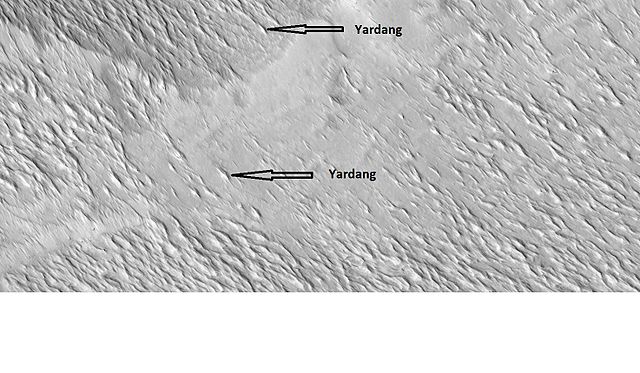
Yardangs in the Medusae Fossae formation, as seen by HiRISE under HiWish program

Close, color view of yardangs, as seen by HiRISE under HiWish program
Amazonis Planitia
Videos
Page
Amazonis Planitia is one of the smoothest plains on Mars. It is located between the Tharsis and Elysium volcanic provinces, to the west of Olympus Mons, in the Amazonis and Memnonia quadrangles, centered at 24.8°N 196.0°E. The plain's topography exhibits extremely smooth features at several different lengths of scale. A large part of the Medusae Fossae Formation lies in Amazonis Planitia.

Image: Amazonis planitia topo
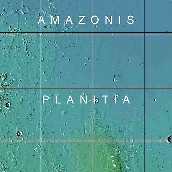
Image: USGS Mars Amazonis Planitia mola
Plateau made up of Medusae Fossae materials and rootless cones, as seen by HiRISE.
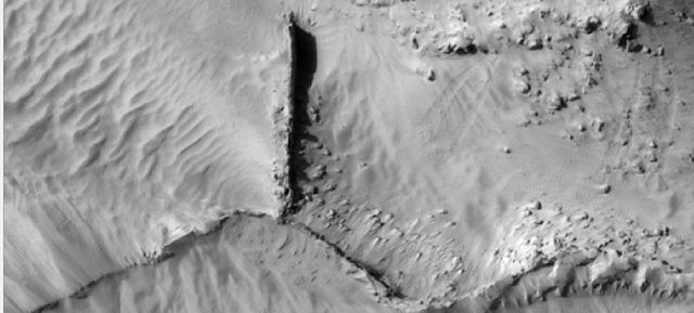
Narrow ridges, as seen by HiRISE under HiWish program. The ridges may be the result of impacts fracturing the surface.