Anacostia
Videos
Page
Anacostia is a historic neighborhood in Southeast Washington, D.C. Its downtown is located at the intersection of Good Hope Road and Martin Luther King Jr. Avenue. It is located east of the Anacostia River, after which the neighborhood is named.

An old Anacostia cottage

The historic neon "Anacostia" sign at 1115 Good Hope Road SE. The sign is the traditional gateway to Historic Old Anacostia.
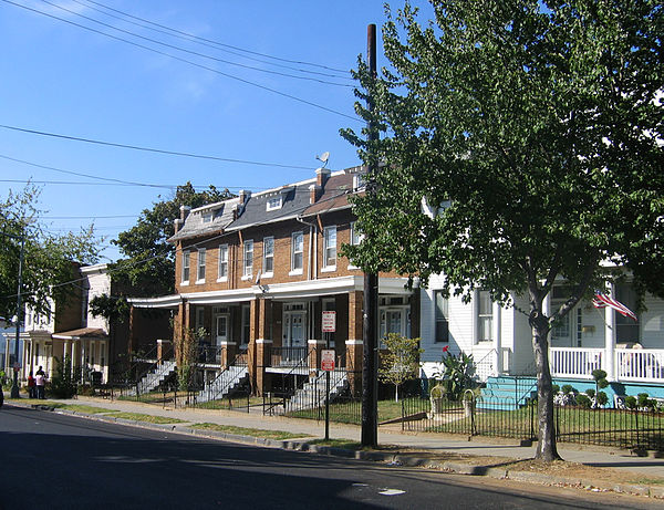
Houses on W Street, SE in Anacostia.
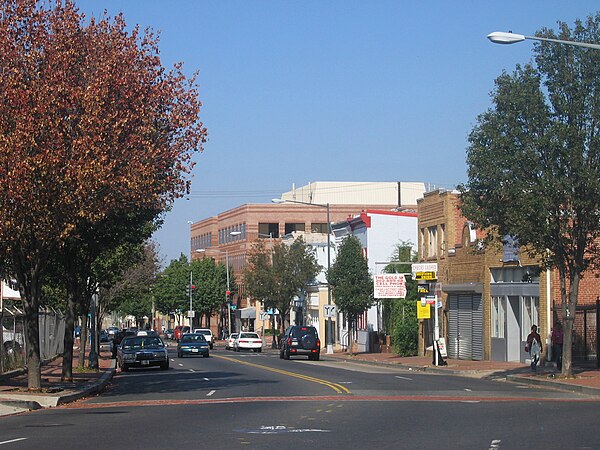
Martin Luther King Jr. Avenue, SE in Anacostia.
Southeast (Washington, D.C.)
Videos
Page
Southeast is the southeastern quadrant of Washington, D.C., the capital of the United States, and is located south of East Capitol Street and east of South Capitol Street. It includes the Capitol Hill and Anacostia neighborhoods, the Navy Yard, the Joint Base Anacostia-Bolling (JBAB), the U.S. Marine Barracks, the Anacostia River waterfront, Eastern Market, the remains of several Civil War-era forts, historic St. Elizabeths Hospital, RFK Stadium, Nationals Park, and the Congressional Cemetery. It also contains a landmark known as "The Big Chair," located on Martin Luther King Jr. Avenue. The quadrant is split by the Anacostia River, with the portion that is west of the river sometimes referred to as "Near Southeast". Geographically, it is the second-smallest quadrant of the city.

Color-enhanced USGS satellite image of Washington, D.C., taken April 26, 2002. The "crosshairs" in the image mark the quadrant divisions of Washington, with the U.S. Capitol at the center of the dividing lines. To the west of the Capitol extends the National Mall, visible as a thin green band in the image. The Northwest quadrant is the largest, located north of the Mall and west of North Capitol Street.
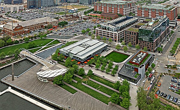
Southeast (Washington DC) The Yards Park at the Antacostia River Front
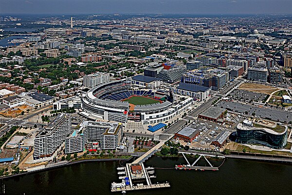
Southeast (Washington DC) Nationals Park Looking Northwest

Southeast (Washington DC) RFK Stadium