Apra Harbor
Videos
Page
Apra Harbor, also called Port Apra, is a deep-water port on the western side of the United States territory of Guam. It is considered one of the best natural ports in the Pacific Ocean. The harbor is bounded by Cabras Island and the Glass Breakwater to the north and the Orote Peninsula in the south. Naval Base Guam and the Port of Guam are the two major users of the harbor. It is also a popular recreation area for boaters, surfers, scuba divers, and other recreationalists.

Apra Harbor from the south, with Naval Base Guam on the Orote Peninsula in the foreground

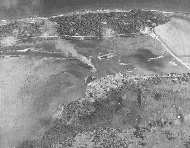
Southern Apra Harbor in 1941, showing the Pan American Airways fuel piers at Sumay, as well as the lagoon that would be constructed into Inner Apra Harbor after the WWII
The bombarded former Piti Navy Yard and causeway to Cabras Island on July 20, 1944, two days before the U.S. landings.

The harbor in 1945
Guam
Videos
Page
Guam is an organized, unincorporated territory of the United States in the Micronesia subregion of the western Pacific Ocean. Guam's capital is Hagåtña, and the most populous village is Dededo. It is the westernmost point and territory of the United States, reckoned from the geographic center of the U.S. In Oceania, Guam is the largest and southernmost of the Mariana Islands and the largest island in Micronesia.

Reception of the Manila Galleon by the Chamorro in the Ladrones Islands, c. 1590 Boxer Codex
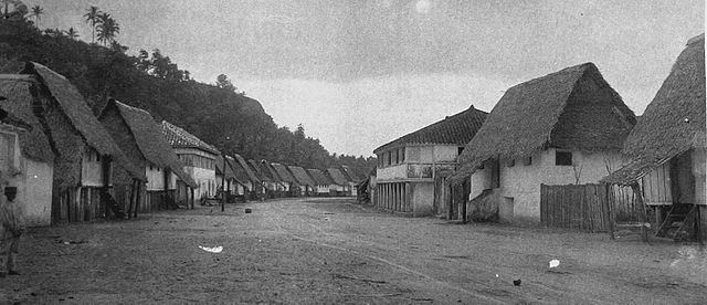
The main street of Hagåtña c. 1899–1900
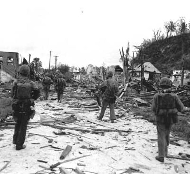
U.S. Marines walk through the ruins of Hagåtña, July 1944.
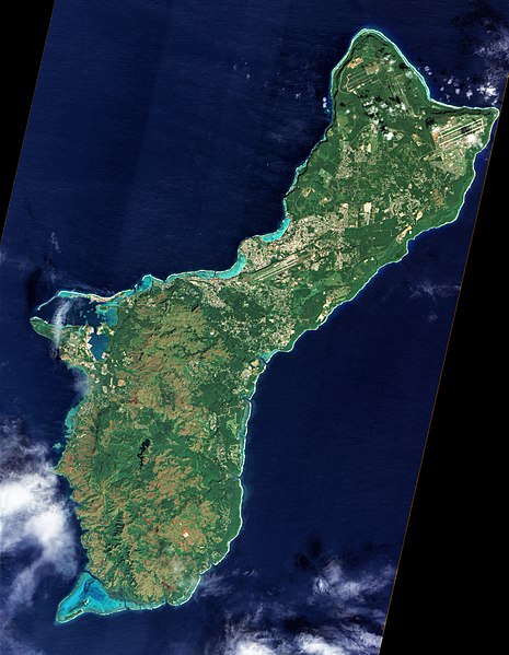
A photograph of Guam from space captured by NASA's now decommissioned Earth observation satellite, Earth Observing-1 (EO-1), December 2011