Arcadia quadrangle
Videos
Page
The Arcadia quadrangle is one of a series of 30 quadrangle maps of Mars used by the United States Geological Survey (USGS) Astrogeology Research Program. The quadrangle is located in the north-central portion of Mars’ western hemisphere and covers 240° to 300° east longitude and 30° to 65° north latitude. The quadrangle uses a Lambert conformal conic projection at a nominal scale of 1:5,000,000 (1:5M). The Arcadia quadrangle is also referred to as MC-3. The name comes from a mountainous region in southern Greece. It was adopted by IAU, in 1958.

Image of the Arcadia quadrangle (MC-3). The southern part contains the large shield volcano Alba Patera and the highly faulted Tempe Terra province, which includes many small volcanoes.
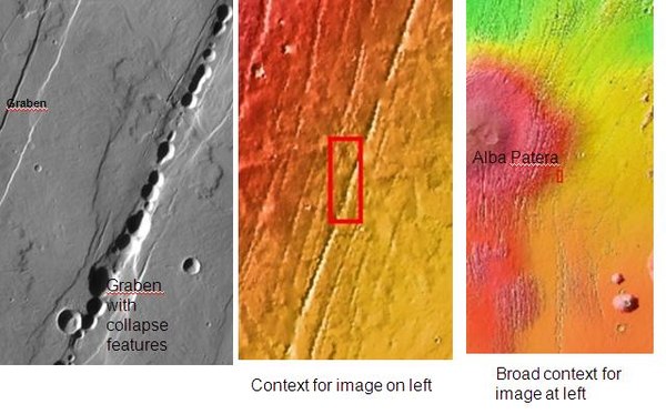
Graben near Alba Patera, as seen by THEMIS. Graben and catenae, collapse features, both caused by faults. When the crust is stretched, faults form and material falls into voids created by the stretching. Uranius Tholus (upper) and Ceraunius Tholus (largest) volcanoes are visible in wide context view, below and to the right of Alba Patera.
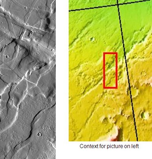
Forces from different directions caused this complex of grabens to form. Picture taken by THEMIS.
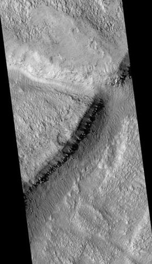
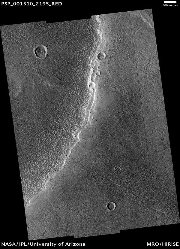
Mareotis Fossae Region, as seen by HiRISE
Alba Mons
Videos
Page
Alba Mons is a volcano located in the northern Tharsis region of the planet Mars. It is the biggest volcano on Mars in terms of surface area, with volcanic flow fields that extend for at least 1,350 km (840 mi) from its summit. Although the volcano has a span comparable to that of the United States, it reaches an elevation of only 6.8 km (22,000 ft) at its highest point. This is about one-third the height of Olympus Mons, the tallest volcano on the planet. The flanks of Alba Mons have very gentle slopes. The average slope along the volcano's northern flank is 0.5°, which is over five times lower than the slopes on the other large Tharsis volcanoes. In broad profile, Alba Mons resembles a vast but barely raised welt on the planet's surface. It is a unique volcanic structure with no counterpart on Earth or elsewhere on Mars.

Viking image of Alba Mons. The volcano's relief is barely visible in orbital photographs. The broad system of fractures on the volcano's eastern side (right) is called Tantalus Fossae. The narrower fracture system on the western flank is Alba Fossae. (Viking color MDIM 2.1)
MOLA exaggerated relief view of Alba Mons central edifice and summit dome viewed from south (top) and north (bottom). Vertical exaggeration is 10x.

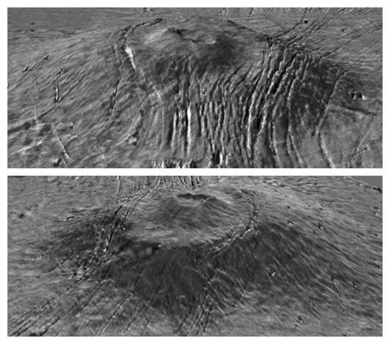
Central caldera complex of Alba Mons. The calderas are shallow compared to those on other Tharsis volcanoes. Within the larger caldera is a small shield capped by a concentric circular feature (near center). Image is about 200 km (120 mi) across (THEMIS daytime IR mosaic).
Dust mantle at the SW edge of small caldera on Alba Mons (HiRISE).