Argyre quadrangle
Videos
Page
The Argyre quadrangle is one of a series of 30 quadrangle maps of Mars used by the United States Geological Survey (USGS) Astrogeology Research Program. The Argyre quadrangle is also referred to as MC-26. It contains Argyre Planitia and part of Noachis Terra.

Image of the Argyre Quadrangle (MC-26). The west-central part contains the Argyre basin, defined by a rim of rugged mountain blocks that surrounds a nearly circular expanse of light-colored plains. The large basin is surrounded by heavily cratered highlands.
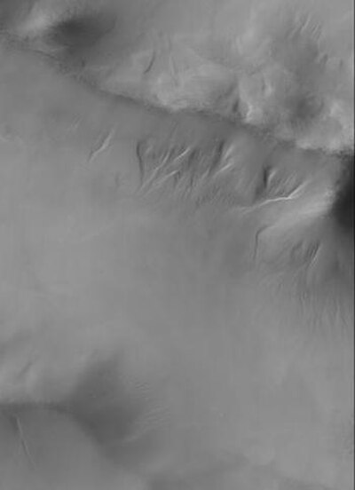
Gullies on the western rim of Argyra Planitia as seen with CTX
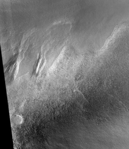
Charitum Montes Gullies, as seen by HiRISE

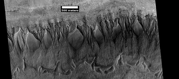
Gullies in Green Crater, as seen by HiRISE
Gullies on Mars
Videos
Page
Martian gullies are small, incised networks of narrow channels and their associated downslope sediment deposits, found on the planet of Mars. They are named for their resemblance to terrestrial gullies. First discovered on images from Mars Global Surveyor, they occur on steep slopes, especially on the walls of craters. Usually, each gully has a dendritic alcove at its head, a fan-shaped apron at its base, and a single thread of incised channel linking the two, giving the whole gully an hourglass shape. They are estimated to be relatively young because they have few, if any craters. A subclass of gullies is also found cut into the faces of sand dunes, that are themselves considered to be quite young. Linear dune gullies are now considered recurrent seasonal features.

Gullies in the southern highlands of Mars, south of Argyre Planitia. 2014 image from the HiRISE camera on the Mars Reconnaissance Orbiter.

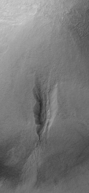
Group of gullies on north wall of crater that lies west of the crater Newton. The alcove and apron of one gully are labelled. These gullies are associated with moraine-like ridges at their downslope ends, which suggests they have formed at the site of a now-absent flowing ice. Note that they are cut into a mantle, which is much smoother than the rough-textured underlying material. Image taken by Mars Global Surveyor.
Gullies in crater in Phaethontis quadrangle, as seen by HiRISE under HiWish program
Gully on mound as seen by Mars Global Surveyor, under the MOC Public Targeting Program. Images of gullies on isolated peaks, like this one, are difficult to explain with the theory of water coming from aquifers because aquifers need large collecting areas.