Auckland Northern Motorway
Videos
Page
The Auckland Northern Motorway in the Auckland Region of New Zealand links Central Auckland and Warkworth in the former Rodney District via the Hibiscus Coast and North Shore. It is part of State Highway 1.

Looking west at the Northern Motorway from Forrest Hill. The Sunset Road overbridge and the Upper Harbour Highway interchange northbound offramp can be seen in the background on the far right. The Northern Busway can be seen on the near side of the motorway.

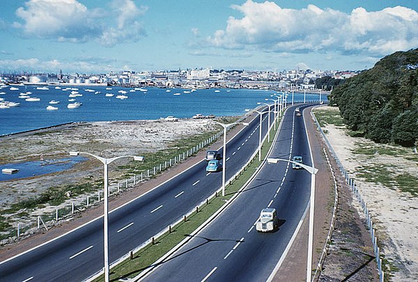
The Northern Motorway skirting the edge of the Waitematā Harbour on the northern approach to the Auckland Harbour Bridge. Central Auckland can be seen across the harbour.
The Northern Motorway between the Auckland Harbour Bridge and the then Fanshawe Street terminus in May 1960. Photo by Denis Wilford.
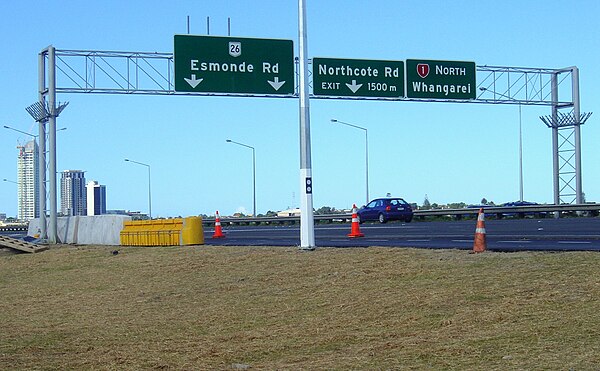
The Northern Motorway northbound lanes, just south of the Esmonde Road interchange.
Auckland isthmus
Videos
Page
The Auckland isthmus, also known as the Tāmaki isthmus, is a narrow stretch of land on the North Island of New Zealand in the Auckland Region, and the location of the central suburbs of the city of Auckland, including the CBD. The isthmus is located between two rias : the Waitematā Harbour to the north, which opens to the Hauraki Gulf / Tīkapa Moana and Pacific Ocean, and the Manukau Harbour to the south, which opens to the Tasman Sea. The isthmus is the most southern section of the Northland Peninsula.

The Auckland isthmus seen from the International Space Station in 2019

Almorah Rock Forest, an ecosystem that once covered much of the Auckland isthmus (pictured: lava rock forest remnant at Withiel Thomas Reserve, Newmarket)

Wetlands and swamps surrounded by Cordyline australis (cabbage trees / tī kōuka) formed in many of the unforested areas of the isthmus (pictured: Cabbage Tree Swamp in Sandringham, circa 1910)
Kūmara (sweet potato) was widely grown on the isthmus during the pre-European period, and stored in rua kūmara (storehouses) (pictured: storehouse pit remnants on Ōhinerau)