Blue Star Memorial Highway
Videos
Page
Blue Star Memorial Highways are highways in the United States that are marked to pay tribute to the U.S. armed forces. The National Council of State Garden Clubs, now known as National Garden Clubs, Inc., started the program in 1945 after World War II. The blue star was used on service flags to denote a service member fighting in the war. The program has since been expanded to include Memorial Markers and Memorial By-ways. These markers are used in National Cemeteries, parks, veterans facilities, and gardens.

Blue Star Memorial Highway marker on Interstate 81 northbound near New Market, Virginia

Marker in Anchor Point, Alaska
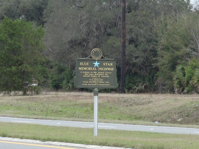
Perry, Florida
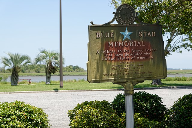
Brunswick, Georgia
California State Route 58
Videos
Page
State Route 58 is a major east-west state highway in the U.S. state of California that runs across the Coast Ranges, the southern San Joaquin Valley, the Tehachapi Mountains, which border the southern Sierra Nevada, and the Mojave Desert. It runs between U.S. Route 101 near Santa Margarita and Interstate 15 in Barstow. It has junctions with Interstate 5 near Buttonwillow, State Route 99 in Bakersfield, State Route 202 in Tehachapi, State Route 14 near Mojave, and U.S. Route 395 at Kramer Junction. SR 58 also provides access to Edwards Air Force Base. At various points it is known as the Calf Canyon Highway, Carrisa Highway, Bakersfield-McKittrick Highway, Rosa Parks Highway, Westside Parkway, Barstow-Bakersfield Highway, Bakersfield Tehachapi Highway, Kern County Korean War Veterans Memorial Highway, and Mojave-Barstow Highway.
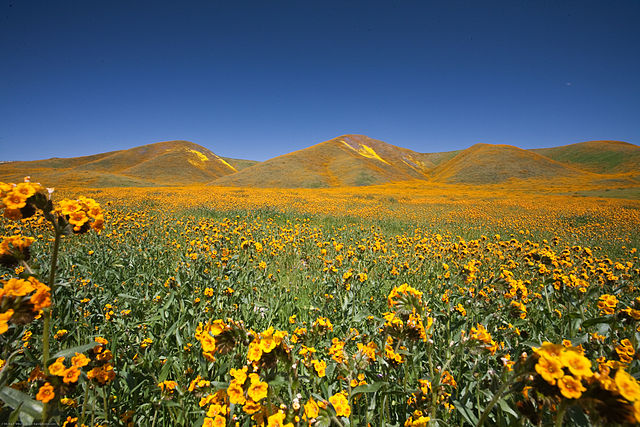
Spring Wildflowers off SR 58 near California Valley, 2010

Westbound SR 58 in the Temblor Range, descending into the Carrizo Plain

A truck passes eastbound along the busy SR 58 through the Antelope Valley. The Tehachapi Mountains are visible in the distance.