Burnage is an area of Manchester, England, 4 miles (6.4 km) south of the city centre and bisected by Kingsway. The population at the 2011 census was 15,227. It lies between Withington to the west, Levenshulme to the north, Heaton Chapel to the east and Didsbury and Heaton Mersey to the south.
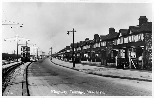
A tram running along Kingsway, c.1930
An example of council housing on Elmhurst Drive, Burnage
The Duchess of York Hospital for Babies in 1953
Burnage Academy on Burnage Lane
Kingsway is a dual carriageway in Greater Manchester, England, which runs from Levenshulme to Cheadle. It is approximately 7.3 mi (11.7 km) long and is a link road between the city centre and the southern suburbs of Greater Manchester, forming part of the A34. Kingsway was built in the late 1920s between Levenshulme and Parrs Wood, and was originally designed as a combined road and tram route. The tram tracks were eventually removed and the road was later extended to bypass Cheadle and join onto the M60 motorway.
Kingsway dual carriageway as it passes through Cheadle
A 1930s photograph of Kingsway in Burnage with a Corporation Tram travelling on the central reservation
Kingsway as it appears today, with a grassed central reservation
1914 illustration of Brodie's dual carriageway layout with a central segregated tram track in Liverpool, which informed the layout of Kingsway