Buzzards Bay
Videos
Page
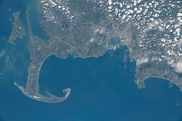
Buzzards Bay is a bay of the Atlantic Ocean adjacent to the U.S. state of Massachusetts. It is approximately 28 miles long by 8 miles wide. It is a popular destination for fishing, boating, and tourism. Buzzards Bay is often considered the finest sailing location on the East Coast and is frequently compared in terms of sailing conditions to San Francisco Bay. Since 1914, Buzzards Bay has been connected to Cape Cod Bay by the Cape Cod Canal. In 1988, under the Clean Water Act, the Environmental Protection Agency and the Commonwealth of Massachusetts designated Buzzards Bay to the National Estuary Program, as "an estuary of national significance" that is threatened by pollution, land development, or overuse.

Buzzards Bay and surrounding area from orbit (looking southwest)
Cape Cod Bay
Videos
Page
Cape Cod Bay is a large bay of the Atlantic Ocean adjacent to the U.S. state of Massachusetts. Measuring 604 square miles (1,560 km2) below a line drawn from Brant Rock in Marshfield to Race Point in Provincetown, Massachusetts, it is enclosed by Cape Cod to the south and east, and Plymouth County, Massachusetts, to the west. To the north of Cape Cod Bay lie Massachusetts Bay and the Atlantic Ocean. Cape Cod Bay is the southernmost extremity of the Gulf of Maine. Cape Cod Bay is one of the bays adjacent to Massachusetts that give it the name Bay State. The others are Narragansett Bay, Buzzards Bay, and Massachusetts Bay.
Cape Cod, Cape Cod Bay, and Massachusetts Bay, north is oriented to the right in this photo taken from the International Space Station on June 15, 2022
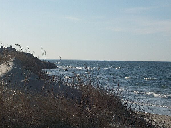
Cape Cod Bay from a beach in Dennis.

The tidal flats in East Brewster
Cape Cod Bay from space