Cahokia
Videos
Page
The Cahokia Mounds State Historic Site is the site of a pre-Columbian Native American city directly across the Mississippi River from present-day St. Louis, Missouri. This historic park lies in south-western Illinois between East St. Louis and Collinsville. The park covers 2,200 acres (890 ha), or about 3.5 square miles (9 km2), and contains about 80 manmade mounds, but the ancient city was much larger. At its apex around 1100 CE, the city covered about 6 square miles (16 km2), included about 120 earthworks in a wide range of sizes, shapes, and functions, and had a population of between 15,000 and 20,000 people.

Monks Mound, the largest earthen structure at Cahokia (for scale, an adult is standing on top)

Cahokia winter solstice sunrise over Fox Mound and the Cahokia Woodhenge ca. 1000 AD. Artist's concept.

Artist's recreation of central Cahokia. Cahokia's east–west baseline transects the Woodhenge, Monk's Mound, and several other large mounds.
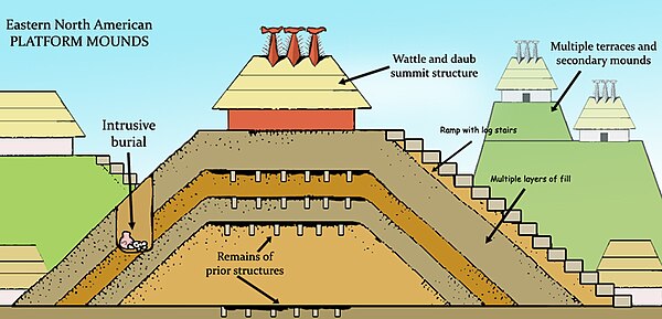
Mississippian period showing the multiple layers of mound construction, mound structures such as temples or mortuaries, ramps with log stairs, and prior structures under later layers, multiple terraces, and intrusive burials
Pre-Columbian era
Videos
Page
In the history of the Americas, the pre-Columbian era, also known as the pre-contact era, spans from the original peopling of the Americas in the Upper Paleolithic to European colonization, which began with Christopher Columbus's voyage of 1492. Usually, the era covers the history of Indigenous cultures until significant influence by Europeans. This may have occurred decades or even centuries after Columbus for certain cultures.
Artist's reconstruction of Poverty Point, 1500 BCE
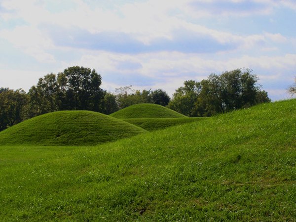
Hopewell mounds from the Mound City group in Ohio
Monks Mound of Cahokia (UNESCO World Heritage Site) in summer. The concrete staircase follows the approximate course of the ancient wooden stairs.

An artistic recreation of The Kincaid site from the prehistoric Mississippian culture as it may have looked at its peak 1050–1400 CE