California State Route 299
Videos
Page
State Route 299 is an east–west state highway in the U.S. state of California that runs across the northern part of the state. At 305.777 miles (492.100 km), it is the third longest California state route, after Route 1 and Route 99, and the longest east-west route. Route 299's western terminus is at US 101 at the northern edge of Arcata, and its eastern terminus is at the Nevada state line at a point east of Cedarville. Between Arcata and Redding, Route 299 intersects with State Route 96, and is briefly co-signed with State Route 3. In Redding, it intersects with State Route 273, State Route 44, and Interstate 5. East of Redding, it intersects with State Route 89, and a section is co-signed with State Route 139 before reaching Alturas. It is then co-signed with U.S. Route 395 northeast of Alturas, and then runs east through Cedarville and to the border with Nevada. A ghost town, Vya, Nevada, can be reached via this route, which after the border becomes a dirt road, which was formerly Nevada State Route 8A. The segment of SR 299 between Arcata and Redding is the Trinity Scenic Byway, a National Forest Scenic Byway.

SR 299 through Fall River Mills, Shasta County
U.S. Route 101 in California
Videos
Page
U.S. Route 101 (US 101) is a major north–south United States Numbered Highway, stretching from Los Angeles, California, to Tumwater, Washington. The California portion of US 101 is one of the last remaining and longest U.S. Routes still active in the state, and the longest highway of any kind in California. US 101 was also one of the original national routes established in 1926. Significant portions of US 101 between the Los Angeles area and the San Francisco Bay Area follow El Camino Real, the commemorative route connecting the former Alta California's 21 missions.

US 101 northbound as it enters downtown Los Angeles

View northward from the Cahuenga Pass, 1972
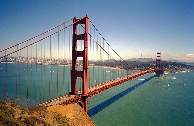
The Golden Gate Bridge, which carries US 101 and SR 1 between San Francisco and Marin County
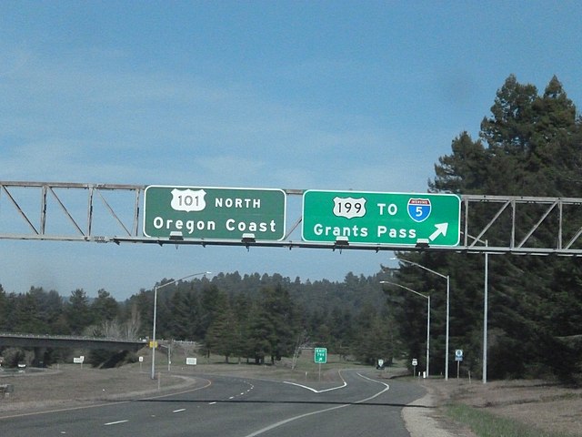
The US 101/US 199 interchange