California coastal sage and chaparral
Videos
Page
The California coastal sage and chaparral is a Mediterranean forests, woodlands, and scrub ecoregion, defined by the World Wildlife Fund, located in southwestern California and northwestern Baja California (Mexico). It is part of the larger California chaparral and woodlands ecoregion. The ecoregion corresponds to the USDA Southern California ecoregion section 261B, and to the EPA Southern California/Northern Baja Coast ecoregion 8.
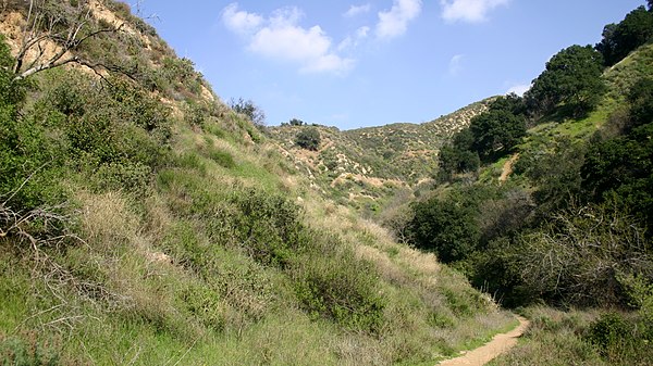
Coastal sage and chaparral of Santa Clarita Woodlands Park

Sea dahlia growing on steep coastal slopes near Ensenada, Baja California
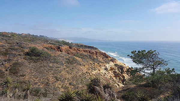
Coastal scrub and torrey pines in the Torrey Pines State Natural Reserve, San Diego

A bobcat roaming the foothills of the Santa Monica Mountains
Baja California
Videos
Page
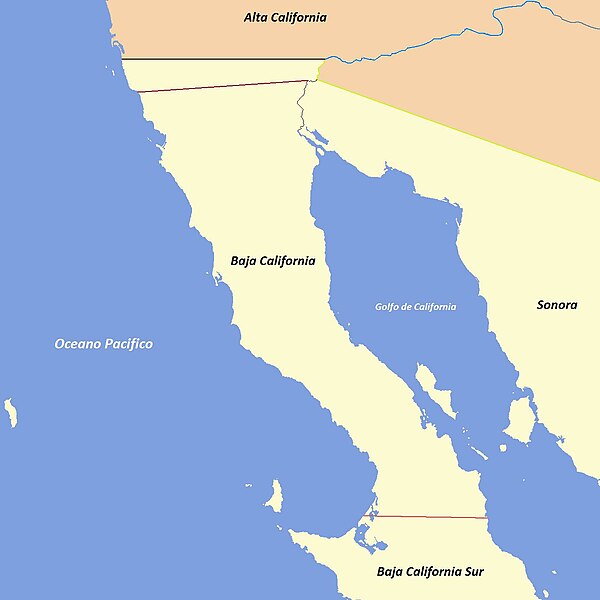
Baja California, officially Estado Libre y Soberano de Baja California, is a state in Mexico. It is the northernmost and westernmost of the 32 federal entities of Mexico. Before becoming a state in 1952, the area was known as the North Territory of Baja California. It has an area of 70,113 km2 (27,071 sq mi) and comprises the northern half of the Baja California Peninsula, north of the 28th parallel, plus oceanic Guadalupe Island. The mainland portion of the state is bordered on the west by the Pacific Ocean; on the east by Sonora, the U.S. state of Arizona, and the Gulf of California; on the north by the U.S. state of California; and on the south by Baja California Sur.
Evolution of the political boundaries of the Californias: Palóu Line (1804–1836) Gila River; border between Las Californias/Alta California and Sonora (1767–1847) Treaty of Guadalupe Hidalgo (1848–Present) Baja California Sur boundary (1931–Present)

Sierra de San Pedro Mártir, with Picacho del Diablo in the center
Encelia californica growing on the Ensenada Municipality coast, typical of the California coastal sage and chaparral ecoregion

Isla Partida, part of the San Lorenzo Marine Archipelago National Park