Drumchapel
Videos
Page
Drumchapel, known locally as 'The Drum', is a district in the north-west of the city of Glasgow, Scotland. It borders Bearsden to the north-east and Drumry to the south-west, as well as Blairdardie, Garscadden, Knightswood and Yoker in Glasgow to the south; land to the north is undeveloped and includes the course of the Roman-era Antonine Wall. The name derives from the Gaelic meaning 'the ridge of the horse'.

Drumchapel housing photographed from the tower blocks at Linkwood Crescent (2014)
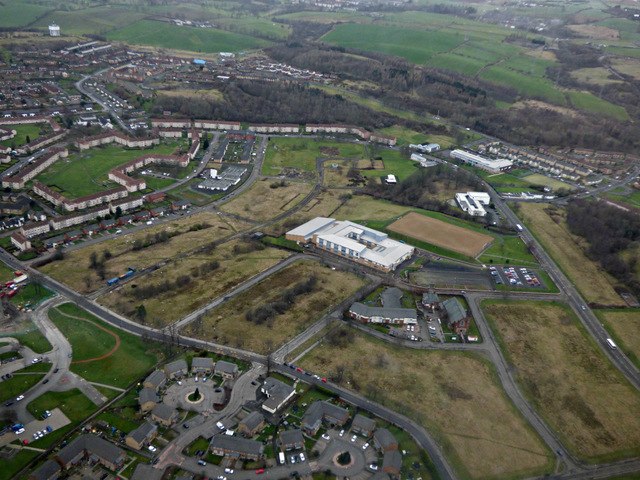
Aerial view of central Drumchapel (2017), with the local secondary school surrounded by expanses of unused land following the demolition of substandard housing, with modern houses and refurbished tenements also in view
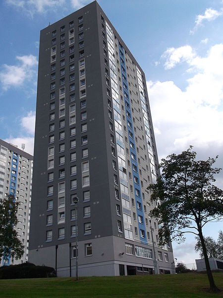
Linkwood Crescent tower blocks (two refurbished in the 2010s, one demolished)

The derelict shopping centre at Drumchapel
Bearsden
Videos
Page
Bearsden is a town in East Dunbartonshire, Scotland, on the northwestern fringe of Greater Glasgow, approximately 6 miles (10 km) from the city centre.
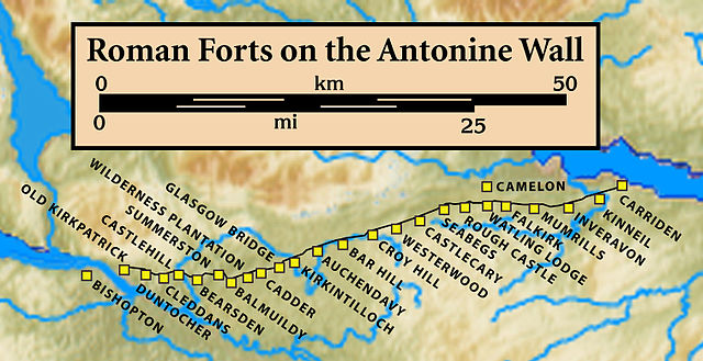
Forts and Fortlets associated with the Antonine Wall from west to east: Bishopton, Old Kilpatrick, Duntocher, Cleddans, Castlehill, Bearsden, Summerston, Balmuildy, Wilderness Plantation, Cadder, Glasgow Bridge, Kirkintilloch, Auchendavy, Bar Hill, Croy Hill, Westerwood, Castlecary, Seabegs, Rough Castle, Camelon, Watling Lodge, Falkirk, Mumrills, Inveravon, Kinneil, Carriden

Stone foundation of the Antonine Wall in New Kilpatrick Cemetery
Former Schaw Convalescent Home, Bearsden, built 1895
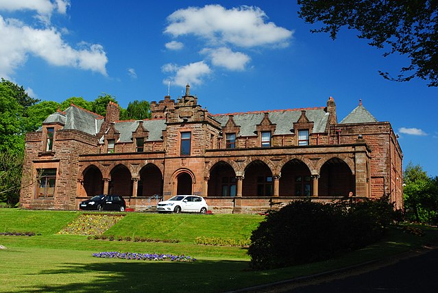
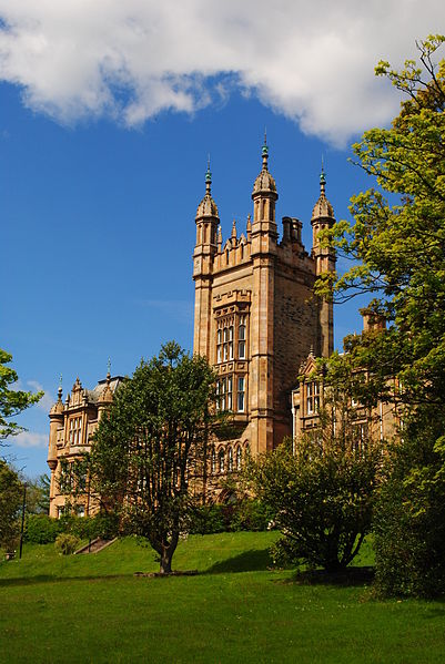
Boclair House, formerly Buchanan Retreat, Bearsden, built 1890. Used by East Dunbartonshire Council's Education Department until 2012, it is now a hotel with housing to the rear.