Fort Mills was the location of US Major General George F. Moore's headquarters for the Philippine Department's Harbor Defenses of Manila and Subic Bays in early World War II, and was the largest seacoast fort in the Philippines. Most of this Coast Artillery Corps fort was built 1904–1910 by the United States Army Corps of Engineers as part of the Taft program of seacoast defense. The fort was named for Brigadier General Samuel Meyers Mills Jr., Chief of Artillery 1905–1906. It was the primary location of the Battle of Corregidor in the Japanese invasion of the Philippines in 1941–42, and of the recapture of Corregidor in February 1945, both in World War II.
The Harbor of Manila and Surrounding Areas
12-inch (305 mm) mortars of Battery Way in 2007
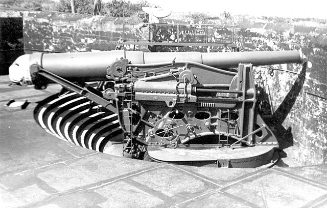
12-inch (305 mm) gun on a disappearing carriage, generally similar to Batteries Cheney, Wheeler, and Crockett
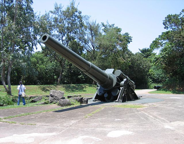
12-inch (305 mm) M1895 gun of Battery Hearn circa 2010
Corregidor is an island located at the entrance of Manila Bay in the southwestern part of Luzon in the Philippines, and is considered part of the Province of Cavite. Due to this location, Corregidor has historically been fortified with coastal artillery batteries to defend the entrance of Manila Bay and Manila itself from attacks by enemy warships. Located 48 kilometres (30 mi) inland, Manila is the nation's largest city and has been the most important seaport in the Philippines for centuries, from the colonial rule of Spain, Japan, and the United States, up through the establishment of the Third Philippine Republic in 1946.
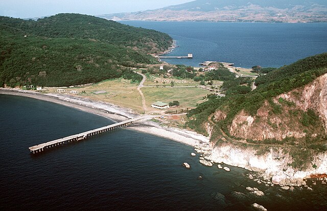
Corregidor Island and the entrance to Manila Bay.
Bottomside in 1982
The entrance to Malinta Tunnel
The surrender of U.S. forces at the Malinta Tunnel on May 6, 1942.