Geodetic datum
Videos
Page
A geodetic datum or geodetic system is a global datum reference or reference frame for precisely representing the position of locations on Earth or other planetary bodies by means of geodetic coordinates. Datums are crucial to any technology or technique based on spatial location, including geodesy, navigation, surveying, geographic information systems, remote sensing, and cartography. A horizontal datum is used to measure a location across the Earth's surface, in latitude and longitude or another coordinate system; a vertical datum is used to measure the elevation or depth relative to a standard origin, such as mean sea level (MSL). Since the rise of the global positioning system (GPS), the ellipsoid and datum WGS 84 it uses has supplanted most others in many applications. The WGS 84 is intended for global use, unlike most earlier datums.
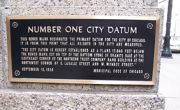
City of Chicago Datum Benchmark
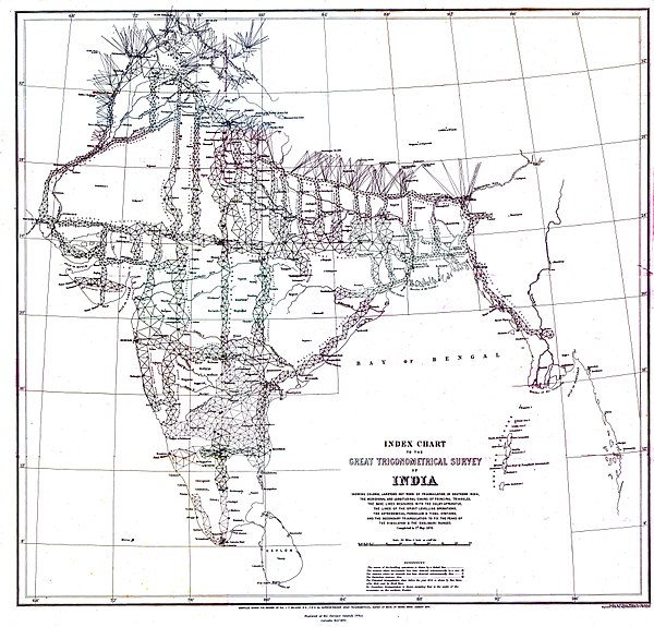
The Great Trigonometrical Survey of India, one of the first surveys comprehensive enough to establish a geodetic datum.
Geodesy
Videos
Page
Geodesy is the science of measuring and representing the geometry, gravity, and spatial orientation of the Earth in temporally varying 3D. It is called planetary geodesy when studying other astronomical bodies, such as planets or circumplanetary systems.
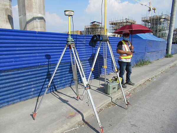
A modern instrument for geodetic measurements using satellites
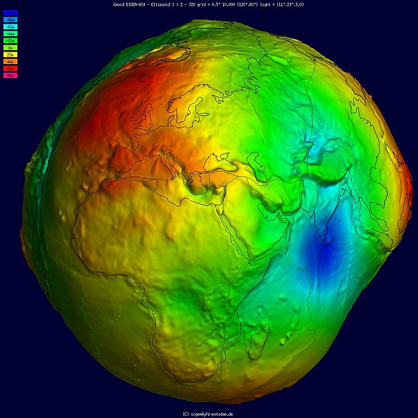
Geoid, an approximation for the shape of the Earth; shown here with vertical exaggeration (10000 vertical scaling factor).

Height measurement using satellite altimetry

GPS Block IIA satellite orbits over the Earth.