Golden Horn
Videos
Page
The Golden Horn is a major urban waterway and the primary inlet of the Bosphorus in Istanbul, Turkey. As a natural estuary that connects with the Bosphorus Strait at the point where the strait meets the Sea of Marmara, the waters of the Golden Horn help define the northern boundary of the peninsula constituting "Old Istanbul", the tip of which is the promontory of Sarayburnu, or Seraglio Point. This estuarial inlet geographically separates the historic center of Istanbul from the rest of the city, and forms a horn shape, sheltered harbor that in the course of history has protected Greek, Roman, Byzantine, Ottoman and other maritime trade ships for thousands of years.
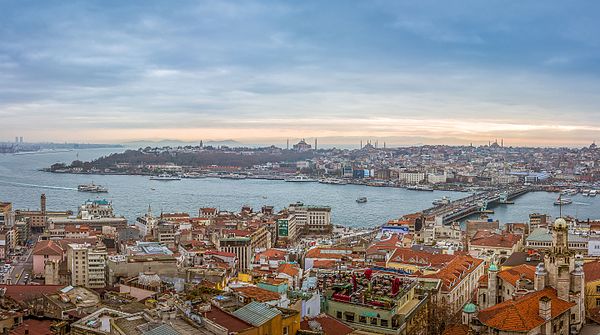
An aerial view of Galata (foreground), the Historic Peninsula (background), and the new Galata Bridge, which straddles the Golden Horn and, connects its two shores at the point where it meets the Bosphorus (off the picture, left) and the Sea of Marmara (behind the Historic Peninsula). Seraglio Point is located at the eastern tip of the Historic Peninsula (center, left). The Princes' Islands are along the horizon, at upper left.

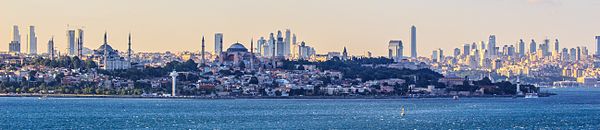
Seraglio Point from Pera, with the Bosphorus (left), the entrance of the Golden Horn (center and right), and the Sea of Marmara (distance) with the Princes' Islands on the horizon

The iron chain preventing a fleet from entering the Golden Horn, depicted in the 12th century Madrid Skylitzes.
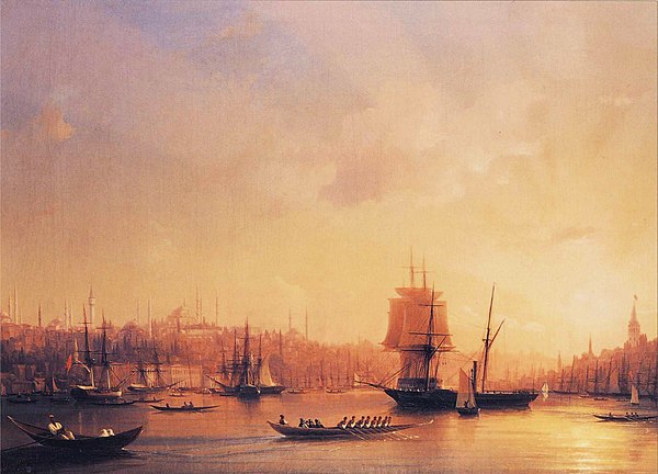
Ivan Constantinovich Aivazovsky's "Dusk on the Golden Horn", depicting the estuary's trademark golden lights. The entrance to the Horn is in the foreground, with the Historic Peninsula (left), and Galata (right).
Bosporus
Videos
Page
The Bosporus or Bosphorus Strait is a natural strait and an internationally significant waterway located in Istanbul, Turkey. The Bosporus connects the Black Sea to the Sea of Marmara and forms one of the continental boundaries between Asia and Europe. It also divides Turkey by separating Anatolia from Thrace. It is the world's narrowest strait used for international navigation.
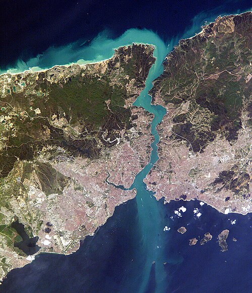
Close-up satellite image of the Bosporus strait, taken from the International Space Station in April 2004. The body of water at the top is the Black Sea, the one at the bottom is the Marmara Sea, and the Bosporus is the winding waterway that connects the two. The western banks of the Bosporus constitute the geographic starting point of the European continent, while the banks to the east are the geographic beginnings of the continent of Asia. The city of
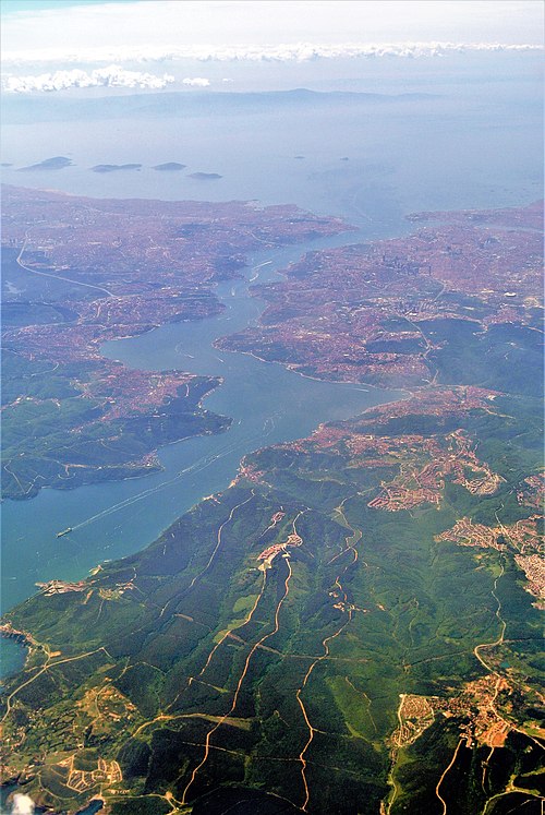
Aerial view of the Bosporus taken from its northern end near the Black Sea (bottom), looking south (top) toward the Marmara Sea, with the city center of Istanbul visible along the strait's hilly banks

The Bosphorus, with the Castles of Europe & Asia. 19th-century engraving by Thomas Allom. The castles are Rumelihisarı and Anadoluhisarı, respectively. The original is a watercolor available in the online collection of the Victoria and Albert Museum.
Modern (2012) view of the European side of Istanbul from the southern entrance to the Bosporus