Hengduan Mountains
Videos
Page
The Hengduan Mountains are a group of mountain ranges in southwest China that connect the southeast portions of the Tibetan Plateau with the Yunnan–Guizhou Plateau. The Hengduan Mountains are primarily large north-south mountain ranges that effectively separate lowlands in northern Myanmar from the lowlands of the Sichuan Basin. These ranges are characterized by significant vertical relief originating from the Indian subcontinent's collision with the Eurasian Plate, and further carved out by the major rivers draining the eastern Tibetan Plateau. These rivers, the Yangtze, Mekong, and Salween, are recognized today as the Three Parallel Rivers UNESCO World Heritage Site.

Mount Gongga, the tallest summit in the Hengduan Mountains

Satellite view of the Hengduan Mountains
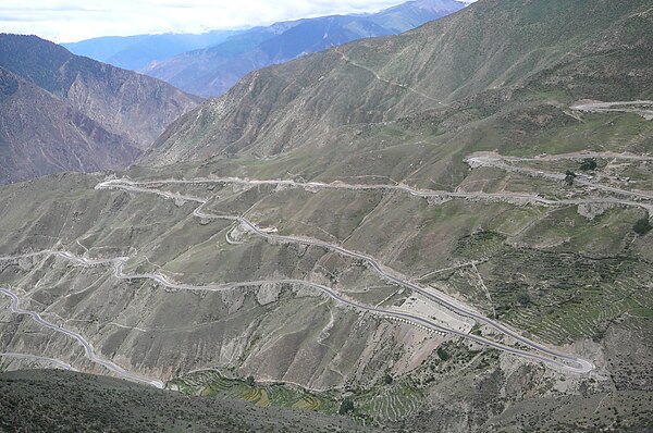
A bird's-eye view of the "Nujiang 72 turns" in Tibet.
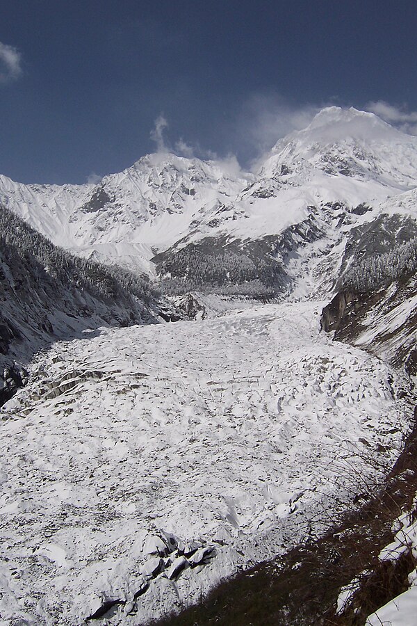
Hailuogou glacier, slopes of Mount Gongga (Minya Konka), Sichuan province.
Tibetan Plateau
Videos
Page
The Tibetan Plateau, also known as Qinghai–Tibet Plateau and Qing–Zang Plateau, is a vast elevated plateau located at the intersection of Central, South, and East Asia covering most of the Tibet Autonomous Region, most of Qinghai, western half of Sichuan, Southern Gansu provinces in Western China, southern Xinjiang, Bhutan, the Indian regions of Ladakh and Lahaul and Spiti as well as Gilgit-Baltistan in Pakistan, northwestern Nepal, eastern Tajikistan and southern Kyrgyzstan. It stretches approximately 1,000 kilometres (620 mi) north to south and 2,500 kilometres (1,600 mi) east to west. It is the world's highest and largest plateau above sea level, with an area of 2,500,000 square kilometres (970,000 sq mi). With an average elevation exceeding 4,500 metres (14,800 ft) and being surrounded by imposing mountain ranges that harbor the world's two highest summits, Mount Everest and K2, the Tibetan Plateau is often referred to as "the Roof of the World".

The Tibetan Plateau lies between the Himalayan range to the south and the Taklamakan Desert to the north. (Composite image)

Yamdrok Lake is one of the four largest lakes in Tibet. All four lakes are considered sacred pilgrimage sites in the local tradition.

Natural-colour satellite image of the Tibetan Plateau.

Yangbajain valley to the north of Lhasa