Hood Canal Bridge
Videos
Page
The Hood Canal Bridge is a floating bridge in the northwest United States, located in western Washington. It carries State Route 104 across Hood Canal in Puget Sound and connects the Olympic and Kitsap Peninsulas. At 7,869 feet in length, it is the longest floating bridge in the world located in a saltwater tidal basin, and the third longest floating bridge overall. It opened in 1961 and was the second concrete floating bridge constructed in Washington. Since that time, it has become a vital link for local residents, freight haulers, commuters, and recreational travelers. The convenience it provides has had a major impact on economic development, especially in eastern Jefferson County.
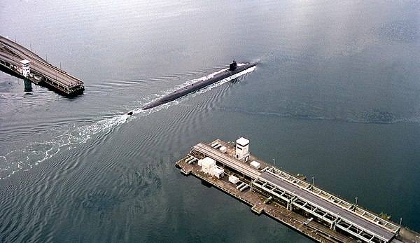
USS Ohio (SSGN-726) maneuvers through the drawspan to her homeport in Bangor
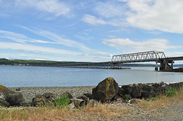
Seen from the north (Termination Point)

Hood Canal Bridge from Buena Vista Cemetery, Port Gamble, Washington.

Aerial view of the bridge's southeast half, with drawspan section at far left
Washington State Route 104
Videos
Page
State Route 104 (SR 104) is a 31.75-mile-long (51.10 km) state highway in the U.S. state of Washington, serving four counties: Jefferson on the Olympic Peninsula, Kitsap on the Kitsap Peninsula, and Snohomish and King in the Puget Sound region. It begins south of Discovery Bay at U.S. Route 101 (US 101) and crosses the Hood Canal Bridge over Hood Canal to the terminus of SR 3 near Port Gamble. SR 104 continues southeast onto the Edmonds–Kingston Ferry to cross the Puget Sound and intersects SR 99 and Interstate 5 (I-5) before ending at SR 522 in Lake Forest Park. SR 104 also has a short spur route that connects the highway to SR 99 at an at-grade signal on the Snohomish–King county line.

SR 104 westbound on the Hood Canal Bridge, traveling towards the Olympic Peninsula

The Jumbo class MV Spokane serving the Edmonds–Kingston route in 2008.

SR 104 Spur at its western terminus, SR 99, on the Snohomish–King county line.