Interstate 680 (California)
Videos
Page
Interstate 680 (I-680) is a north–south auxiliary Interstate Highway in Northern California. It curves around the eastern cities of the San Francisco Bay Area from San Jose to I-80 at Fairfield, bypassing cities along the eastern shore of San Francisco Bay such as Oakland and Richmond while serving others more inland such as Pleasanton and Concord.

Southbound at SR 4, with Mount Diablo on the left

Pleasant Hill, Concord, Martinez, and Vallejo aerial looking north, with I-680, the EBMUD Trail, the Walnut Creek, and the bridges over the Carquinez Strait. I-680 roughly parallels the Walnut Creek (the orange channel) from Walnut Creek to the Carquinez Strait.
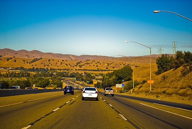
Descending from Mission Pass northbound
Interstate 80 in California
Videos
Page
Interstate 80 (I-80) is a transcontinental Interstate Highway in the United States, stretching from San Francisco, California, to Teaneck, New Jersey. The segment of I-80 in California runs east from San Francisco across the San Francisco–Oakland Bay Bridge to Oakland, where it turns north and crosses the Carquinez Bridge before turning back northeast through the Sacramento Valley. I-80 then traverses the Sierra Nevada, cresting at Donner Summit, before crossing into the state of Nevada within the Truckee River Canyon. The speed limit is at most 65 mph (105 km/h) along the entire route instead of the state's maximum of 70 mph (110 km/h) as most of the route is in either urban areas or mountainous terrain. I-80 has portions designated as the Eastshore Freeway and Alan S. Hart Freeway.

The western terminus of I-80 in San Francisco, viewed from northbound US 101

Eastshore Freeway in Berkeley, view south toward Pacific Park Plaza in Emeryville
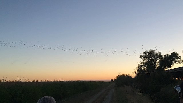
Bats flying from under the Yolo Causeway in Yolo County
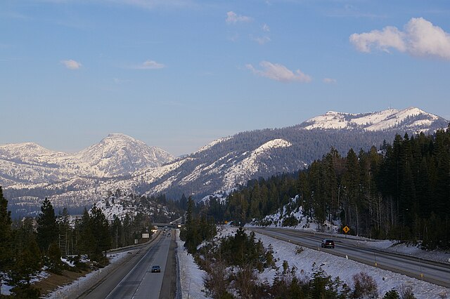
Looking northeast along I-80 in the Sierra Nevada from the Yuba Gap overpass