Ismenius Lacus quadrangle
Videos
Page
The Ismenius Lacus quadrangle is one of a series of 30 quadrangle maps of Mars used by the United States Geological Survey (USGS) Astrogeology Research Program. The quadrangle is located in the northwestern portion of Mars' eastern hemisphere and covers 0° to 60° east longitude and 30° to 65° north latitude. The quadrangle uses a Lambert conformal conic projection at a nominal scale of 1:5,000,000 (1:5M). The Ismenius Lacus quadrangle is also referred to as MC-5. The southern and northern borders of the Ismenius Lacus quadrangle are approximately 3,065 km (1,905 mi) and 1,500 km (930 mi) wide, respectively. The north-to-south distance is about 2,050 km (1,270 mi). The quadrangle covers an approximate area of 4.9 million square km, or a little over 3% of Mars' surface area. The Ismenius Lacus quadrangle contains parts of Acidalia Planitia, Arabia Terra, Vastitas Borealis, and Terra Sabaea.
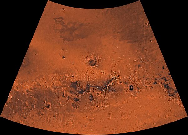
Image of the Ismenius Lacus Quadrangle (MC-5). The northern area contains relatively smooth plains; the central area, mesas and buttes; and the southern area, numerous craters.

Cadmus slaying the dragon of the Ismenian Spring
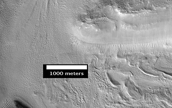
Smooth cliff of Mamers Valles. Note the lack of boulders. Much of the surface may have just been blown in or dropped from the sky (as dirty frost). Image from HiRISE.
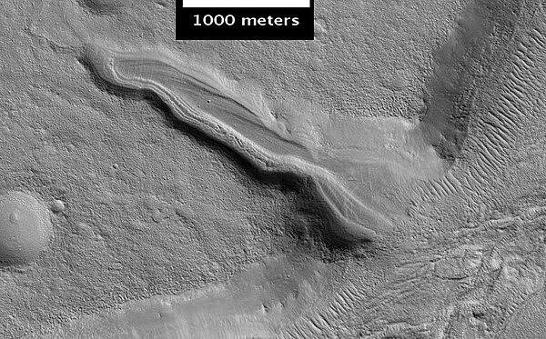
Layered deposit in Mamers Valles, as seen by HiRISE
Arabia Terra
Videos
Page
Arabia Terra is a large upland region in the north of Mars that lies mostly in the Arabia quadrangle, but a small part is in the Mare Acidalium quadrangle. It is densely cratered and heavily eroded. This battered topography indicates great age, and Arabia Terra is presumed to be one of the oldest terrains on the planet. It covers as much as 4,500 km (2,800 mi) at its longest extent, centered roughly at 21°N 6°E with its eastern and southern regions rising 4 km (13,000 ft) above the north-west. Alongside its many craters, canyons wind through the Arabia Terra, many emptying into the large northern lowlands of the planet, which borders Arabia Terra to the north.
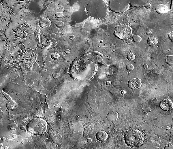
THEMIS daytime infrared image mosaic showing Eden Patera (at center), one of the proposed volcanic caldera complexes in Arabia Terra, and its surroundings

Ice sheet in Oxus Patera, a caldera in Arabia Terra. The scalloped nicks along the spines of the caldera's ridges are likely cracks caused by the expansion and contraction of ice.
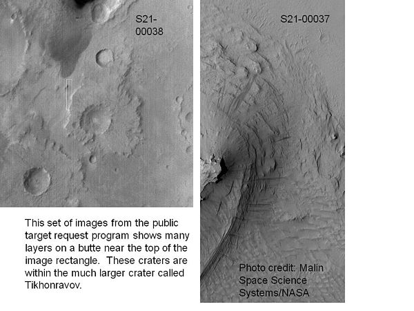
Layers in Tikhonravov Crater in Arabia, as seen by Mars Global Surveyor (MGS). Layers may form from volcanoes, the wind, or by deposition under water. The craters on the left are pedestal craters. Some researchers believe this crater once held a massive lake.

Tikhonravov Crater floor, as seen by Mars Global Surveyor. Click on image to see dark slope streaks and layers.