Kirinyaga County
Videos
Page
Kirinyaga County is a county in the former Central Province of Kenya, located south of Mount Kenya. Its capital is Kutus and its largest town is Wanguru. In 2019, the county had a population of 610,411 people and an area of 1,478.1 km2. The county is bordered to the east and south by Embu County, to the south by a tiny part of Machakos County, to the southwest by Murang'a County and to the northwest by Nyeri County.
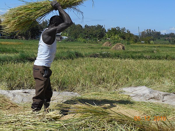
Rice threshing in Mwea

Animal husbandry in Kirinyaga County
Mount Kenya
Videos
Page
Mount Kenya is an extinct volcano in Kenya and the second-highest peak in Africa, after Kilimanjaro. The highest peaks of the mountain are Batian, Nelion and Point Lenana. Mount Kenya is located in the former Eastern and Central provinces of Kenya; its peak is now the intersection of Meru, Embu, Kirinyaga, Nyeri and Tharaka Nithi counties, about 16.5 kilometres south of the equator, around 150 km (90 mi) north-northeast of the capital Nairobi. Mount Kenya is the source of the name of the Republic of Kenya.
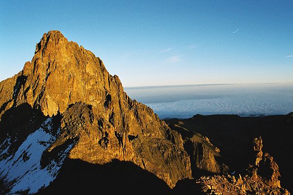
Mount Kenya
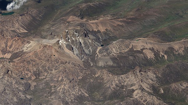
Mount Kenya, as seen from a SkySat satellite
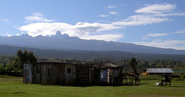
Several ethnic groups that live around Mount Kenya believe the mountain to be sacred. They used to build their houses facing the mountain, with the doors on the side nearest to it.
![Mount Kenya was a stratovolcano and probably looked similar to Mt. Fuji[citation needed] (shown above). The lower slopes are still this shape, which i](https://upload.wikimedia.org/wikipedia/commons/thumb/c/cd/Fuji_Kawaguchi_357.JPG/600px-Fuji_Kawaguchi_357.JPG)
Mount Kenya was a stratovolcano and probably looked similar to Mt. Fuji[citation needed] (shown above). The lower slopes are still this shape, which is how the previous height is estimated.