Ladakh is a region administered by India as a union territory and constitutes an eastern portion of the larger Kashmir region that has been the subject of a dispute between India and Pakistan since 1947 and India and China since 1959. Ladakh is bordered by the Tibet Autonomous Region to the east, the Indian state of Himachal Pradesh to the south, both the Indian-administered union territory of Jammu and Kashmir and the Pakistan-administered Gilgit-Baltistan to the west, and the southwest corner of Xinjiang across the Karakoram Pass in the far north. It extends from the Siachen Glacier in the Karakoram range to the north to the main Great Himalayas to the south. The eastern end, consisting of the uninhabited Aksai Chin plains, is claimed by the Indian Government as part of Ladakh, but has been under Chinese control.
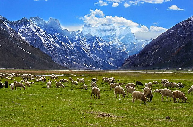
Image: Rangdum village grazing fields
Image: Shyok river Ladakh
South Asia in 565 CE
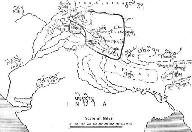
The empire of Kyide Nyimagon divided among his three sons, c. 930 CE. The border between Ladakh/Maryul and Guge-Purang is shown in a thin dotted line, north of Gartok
Kashmir is the northernmost geographical region of the Indian subcontinent. Until the mid-19th century, the term "Kashmir" denoted only the Kashmir Valley between the Great Himalayas and the Pir Panjal Range. Today, the term encompasses a larger area that includes the India-administered territories of Jammu and Kashmir and Ladakh, the Pakistan-administered territories of Azad Kashmir and Gilgit-Baltistan, and the Chinese-administered territories of Aksai Chin and the Trans-Karakoram Tract.
Pahalgam Valley, Kashmir
Nanga Parbat in Kashmir, the ninth-highest mountain on Earth, is the western anchor of the Himalayas
The prevailing religions by district in the 1901 Census of the Indian Empire
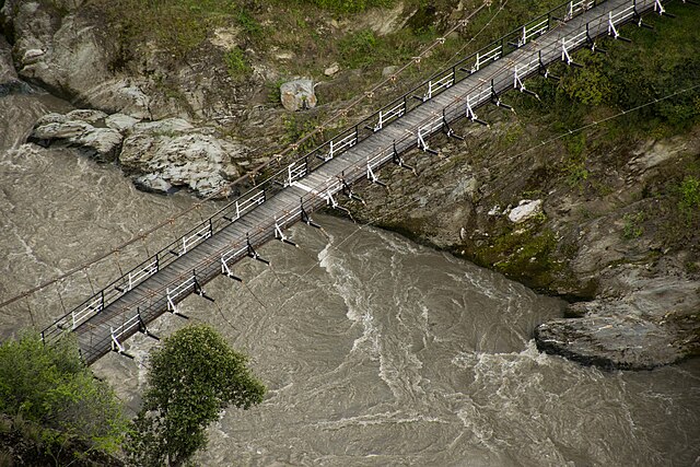
A white border painted on a suspended bridge delineates Azad Kashmir from Jammu and Kashmir