Lake Agassiz
Videos
Page
Lake Agassiz was a large proglacial lake that existed in central North America during the late Pleistocene, fed by meltwater from the retreating Laurentide Ice Sheet at the end of the last glacial period. At its peak, the lake's area was larger than all of the modern Great Lakes combined.

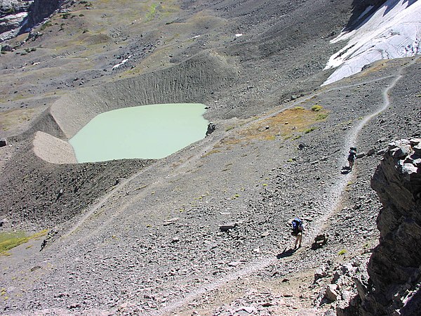
Traverse Gap in the riverbed of Glacial River Warren. The former southern outlet of Lake Agassiz and source of River Warren is at Lake Traverse at the bottom of the photo; the flooded valley in the center (now Brown's Valley) and Big Stone Lake in the distance are relics of the river.

Lockhart Phase of Lake Agassiz, c. 13,000 YBP. Teller and Leverington, 2004 (U.S. Geological Survey)
Proglacial lake
Videos
Page
In geology, a proglacial lake is a lake formed either by the damming action of a moraine during the retreat of a melting glacier, a glacial ice dam, or by meltwater trapped against an ice sheet due to isostatic depression of the crust around the ice. At the end of the last ice age about 10,000 years ago, large proglacial lakes were a widespread feature in the northern hemisphere.

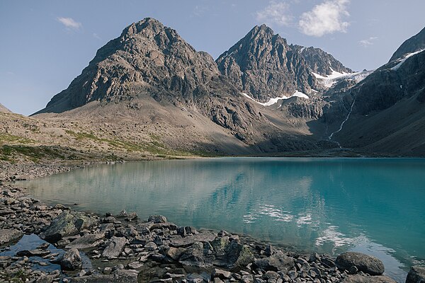
Argentinian proglacial lakes: Lago Viedma (middle), Lago Argentino (left) and Lago San Martin (right). Retreating glaciers are visible at the top.
Tarn—a proglacial lake impounded by the terminal moraine of the retreating Schoolroom Glacier in Grand Teton National Park, Wyoming
Lake Blåvatnet in Lyngen Alps, Norway located below Lenangsbreene glaciers and surrounded by several moraines formed during Younger Dryas and early Holocene
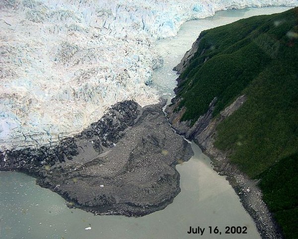
The Hubbard Glacier closed off the Russell Fjord from Disenchantment Bay in 2002 to cause the waters behind the glacier to rise 61 feet (19 m) over 10 weeks in a proglacial lake until they broke through.