Lake Street (Chicago)
Videos
Page
Lake Street is an east–west street in Chicago and part of its suburbs. A portion of Lake Street is designated as U.S. Route 20. Lake Street begins in downtown Chicago and travels west to the eastern terminus of the Elgin Bypass around suburban Elgin. The street travels west through the city and then begins to travel in a northwest fashion through several suburbs. The street is a distance of roughly 34.4 miles (55.4 km).
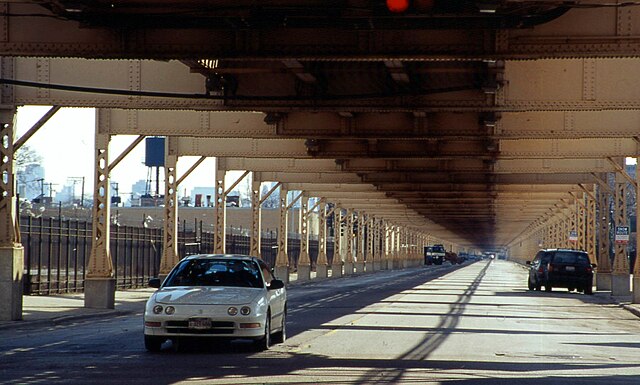
The Green Line elevated tracks run above Lake Street in Chicago. April 2002
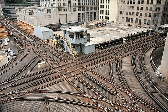
Chicago Transit Authority signal tower 18 guides elevated Chicago 'L' north and southbound Purple and Brown lines intersecting with east and westbound Pink and Green lines and the looping Orange line above the Wells and Lake street intersection in the loop.
U.S. Route 20 in Illinois
Videos
Page
U.S. Route 20 (US 20) in the U.S. state of Illinois is a major arterial highway that runs from the Iowa state line at East Dubuque at the northwestern tip of Illinois to the Indiana state line at Chicago south of the Chicago Skyway, a distance of 233.93 miles (376.47 km). For its entire length, US 20 is designated as the General Ulysses S. Grant Highway, often abbreviated the U.S. Grant Memorial Highway. However, this name is only commonly used west of Elgin. US 20 bypasses the city of Elgin on a freeway known as the Elgin Bypass or Dr. Martin Luther King Jr. Memorial Highway. From Elgin to Melrose Park, US 20 follows Lake Street. It then follows Mannheim Road and, further south, La Grange Road. US 20 also follows 95th Street as it turns east through Chicago's southwestern suburbs. It ultimately leaves Illinois on Indianapolis Boulevard.
The US 20/IL 84 bridge over the Galena River in Galena

Markers for the original Ulysses S. Grant Highway on Old Lake Street in Bartlett