Mare Australe quadrangle
Videos
Page
The Mare Australe quadrangle is one of a series of 30 quadrangle maps of Mars used by the United States Geological Survey (USGS) Astrogeology Research Program. The Mare Australe quadrangle is also referred to as MC-30. The quadrangle covers all the area of Mars south of 65°, including the South polar ice cap, and its surrounding area. The quadrangle's name derives from an older name for a feature that is now called Planum Australe, a large plain surrounding the polar cap. The Mars polar lander crash landed in this region.

Image of the Mare Australe Quadrangle (MC-30). The region includes the South Polar ice cap. The central part is mainly a permanent residual ice cap surrounded by layered and troughed terrain which is, in turn, encircled by heavily cratered terrain.
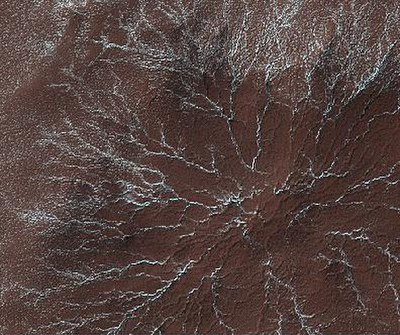
Star burst Channels caused by escaping gas, as seen by HiRISE. Star burst channels, also called spiders, may be about 500 meters in diameter and 1 meter deep.
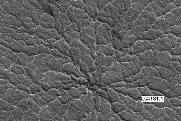
Spider on the second Martian day of spring, as seen by HiRISE
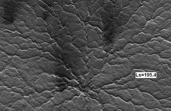
Some spider 14 Martian days later, as seen by HiRISE. Notice increased dark fans caused by outgassing of carbon dioxide and dark material.
Mare Boreum quadrangle
Videos
Page
The Mare Boreum quadrangle is one of a series of 30 quadrangle maps of Mars used by the United States Geological Survey (USGS) Astrogeology Research Program. The Mare Boreum quadrangle is also referred to as MC-1. Its name derives from an older name for a feature that is now called Planum Boreum, a large plain surrounding the polar cap.
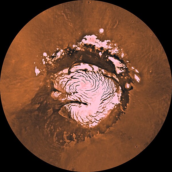
Image of the Mare Boreum Quadrangle (MC-1). The region includes the North Polar ice cap, Korolov crater and Chasma Boreale.
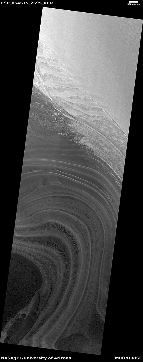
Layers exposed in northern ice cap, as seen by HiRISE under HiWish program
Layers exposed in northern ice cap, as seen by HiRISE under HiWish program

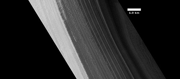
Close view of layers exposed in northern ice cap, as seen by HiRISE under HiWish program