Nantahala National Forest
The Nantahala National Forest is the largest of the four national forests in North Carolina, lying in the mountains and valleys of western North Carolina. The Nantahala is the second wettest region in the country, after the Pacific Northwest. Due to its environmental importance and historical ties with the Cherokee, the forest was officially established on January 29, 1920, by President Woodrow Wilson. The word "Nantahala" is a Cherokee derived, meaning "Land of the Noonday Sun." In some spots, the sun reaches the floors of the deep gorges of the forest only when it is high overhead at midday. This was part of the homeland of the historic Cherokee and their indigenous ancestors, who have occupied the region for thousands of years. The Nantahala River runs through it.
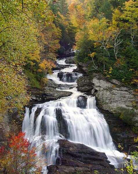
Cullasaja Falls, Nantahala National Forest, in Macon County, North Carolina
Joyce Kilmer Memorial Forest
Ancient tulip poplar grove in Joyce Kilmer Memorial Forest.
Picnic site in the park, 1937.
The Nantahala River is a river in western North Carolina in the United States, within the Nantahala National Forest, and near the Great Smoky Mountains National Park. Two-lane U.S. Highway 19/74 runs along the river, picnic areas dotting the route. In 1839, this was an unimproved large path, part of what became known as the Trail of Tears as the Cherokee people were forcibly removed from their homelands in this region to west of the Mississippi River and Indian Territory.
Nantahala Bridge, showing the high water level even in late summer (September).
Playboater on the Nantahala River
Mist in Nantahala Gorge, where cold water is released from the dam