New Haven Green
Videos
Page
The New Haven Green is a 16-acre (65,000 m2) privately owned park and recreation area located in the downtown district of the city of New Haven, Connecticut, United States. It comprises the central square of the nine-square settlement plan of the original Puritan colonists in New Haven, and was designed and surveyed by colonist John Brockett. Today the Green is bordered by the modern paved roads of College, Chapel, Church, and Elm streets. Temple Street bisects the Green into upper (northwest) and lower (southeast) halves.

The Green is a popular venue for festivals

The upper Green in spring

The crypt at Center Church-on-the-Green

United Church with Union and New Haven Trust Building in background
New Haven, Connecticut
Videos
Page
New Haven is a city in New Haven County, Connecticut, United States. It is located on New Haven Harbor on the northern shore of Long Island Sound and is part of the New York City metropolitan area. With a population of 135,081 as determined by the 2020 U.S. census, New Haven is the third largest city in Connecticut after Bridgeport and Stamford, the largest city in the South Central Connecticut Planning Region, and the principal municipality of Greater New Haven, which had a total population of 864,835 in 2020. Prior to 1960, it was the county seat of New Haven County until the county governments were abolished that year.

Image: East Rock from SSS Hall, October 17, 2008
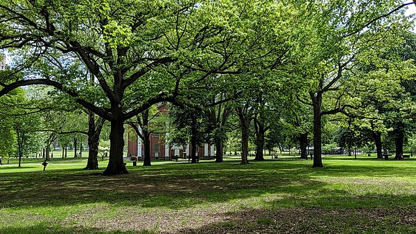
Image: New Haven Green with Center Church
Image: Upper State 4
Image: Harkness Tower, high contrast