The Norwegian Sea is a marginal sea, grouped with either the Atlantic Ocean or the Arctic Ocean, northwest of Norway between the North Sea and the Greenland Sea, adjoining the Barents Sea to the northeast. In the southwest, it is separated from the Atlantic Ocean by a submarine ridge running between Iceland and the Faroe Islands. To the north, the Jan Mayen Ridge separates it from the Greenland Sea.
The Vestfjorden with the mountains of the Lofoten archipelago seen from Løvøy Island in Steigen. Vågakaillen (942 m) is the taller of the two peaks in the centre of the image.
Norwegian Sea, surrounded by shallower seas to the south (North Sea) and northeast (Barents Sea). The white dot near the centre is Jan Mayen, and the dot between Spitsbergen (large island to the north) and Norway is Bear Island.
Vedøya, Skumvær and Røst islands, Lofoten, Norway
Surface currents in the North Atlantic
The Atlantic Ocean is the second-largest of the world's five oceans, with an area of about 85,133,000 km2 (32,870,000 sq mi). It covers approximately 17% of Earth's surface and about 24% of its water surface area. During the Age of Discovery, it was known for separating the New World of the Americas from the Old World of Afro-Eurasia.
As the Gulf Stream meanders across the North Atlantic from the North American east coast to Western Europe its temperature drops by 20 °C (36 °F).
Path of the thermohaline circulation. Purple paths represent deep-water currents, while blue paths represent surface currents.
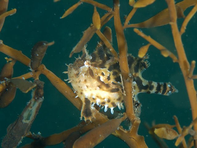
Sargassum fish (Histrio histrio)
Iceberg A22A in the South Atlantic Ocean


