Omaha–Council Bluffs metropolitan area
Videos
Page
The Omaha metropolitan area, officially known as the Omaha, NE–IA, Metropolitan Statistical Area (MSA), is an urbanized, bi-state metro region in Nebraska and Iowa in the American Midwest, centered on the city of Omaha, Nebraska. The region consists of eight counties, and extends over a large area on both sides of the Missouri River. Covering 4,407 square miles (11,410 km2) and with a population of 967,604 (2020), the Omaha metropolitan area is the most populous in both Nebraska and Iowa, and is the 58th most populous MSA in the United States. The 2003 revision to metropolitan area definitions was accompanied by the creation of micropolitan areas and combined statistical areas. Fremont, in Dodge County, Nebraska, was designated a micropolitan area. The Omaha–Fremont Combined Statistical Area has a population of 1,058,125 .
Approximately 1.5 million people reside within the Greater Omaha area, within a 50 mi (80 km) radius of Downtown Omaha.

Downtown Omaha
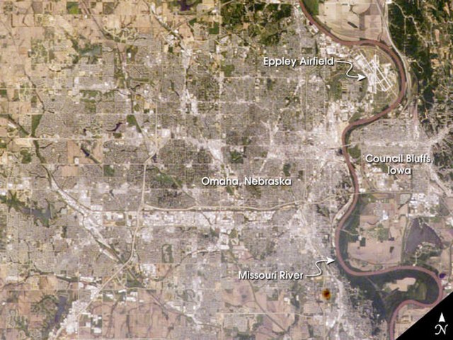
View from space of Omaha and Council Bluffs

The Downtown Omaha skyline from North Downtown.
Iowa
Videos
Page
Iowa is a landlocked state in the upper Midwestern region of the United States. It borders the Mississippi River to the east and the Missouri River and Big Sioux River to the west; Wisconsin to the northeast, Illinois to the east and southeast, Missouri to the south, Nebraska to the west, South Dakota to the northwest, and Minnesota to the north.

Excavation of the 3,800-year-old Edgewater Park Site
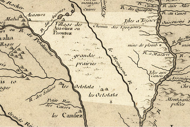
Iowa in 1718 with the modern state area highlighted

Iowa Territorial Seal
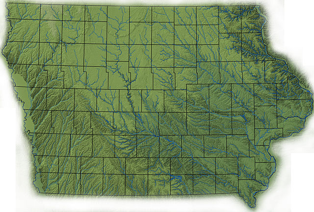
Topography of Iowa, with counties and major streams