Pennsylvania Avenue
Videos
Page
Pennsylvania Avenue is a primarily diagonal street in Washington, D.C. that connects the United States Capitol with the White House and then crosses northwest Washington, D.C. to Georgetown. Traveling through southeast Washington from the Capitol, it enters Prince George's County, Maryland, and becomes MD Route 4 and then MD Route 717 in Upper Marlboro, and finally Stephanie Roper Highway.

Pennsylvania Avenue with the U.S. Capitol in the background

A 1942 photo of Pennsylvania Avenue and 14th Street N.W. in front of the U.S. Department of Commerce

A Pennsylvania Avenue N.W. street sign near the White House
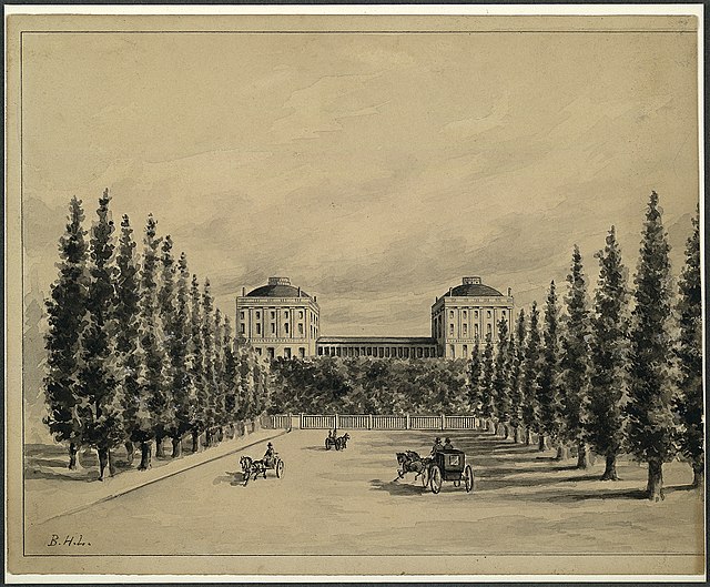
An illustration of Pennsylvania Avenue and the U.S. Capitol before it was burned down by the British on August 24, 1814, during the War of 1812
United States Capitol
Videos
Page
The United States Capitol, often called the Capitol or the Capitol Building, is the seat of the United States Congress, the legislative branch of the federal government. It is located on Capitol Hill at the eastern end of the National Mall in Washington, D.C. Although no longer at the geographic center of the national capital, the U.S. Capitol forms the origin point for the street-numbering system of the district as well as its four quadrants.

The west front of the U.S. Capitol in 1997

The east front of the United States Capitol in 2013

The east front at night in 2013
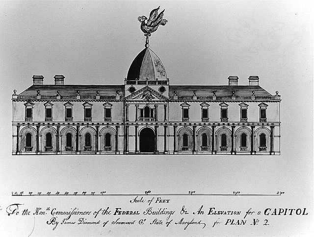
Design for the U.S. Capitol, "An Elevation for a Capitol", a 1792 submission by James Diamond was ultimately not selected