Port of Grimsby
Videos
Page
The Port of Grimsby is located on the south bank of the Humber Estuary at Grimsby in North East Lincolnshire. Sea trade out of Grimsby dates to at least the medieval period. The Grimsby Haven Company began dock development in the late 1700s, and the port was further developed from the 1840s onwards by the Manchester, Sheffield and Lincolnshire Railway (MSLR) and its successors. The port has had three main dock systems:

View across No.3 dock slipways and No.1 dock to Dock tower and Humber (2007)
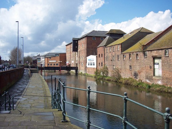
The West Haven (River Freshney) and 18th century maltings (2008)

1872 swing bridge
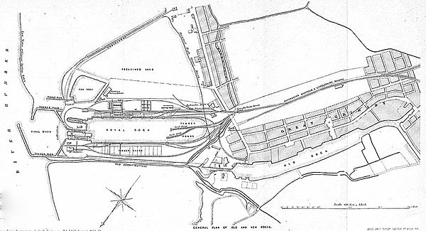
The new Royal and first Fish dock, c. 1864. showing (left to right) Humber, low water mark, basin piers, docks, railway and town (up is south-east)
Humber
Videos
Page
The Humber is a large tidal estuary on the east coast of Northern England. It is formed at Trent Falls, Faxfleet, by the confluence of the tidal rivers Ouse and Trent. From there to the North Sea, it forms part of the boundary between the East Riding of Yorkshire on the north bank and North Lincolnshire on the south bank. Although the Humber is an estuary from the point at which it is formed, many maps show it as the River Humber.

The Humber from the International Space Station