Putah Creek
Videos
Page
Putah Creek is a major stream in Northern California, a tributary of the Yolo Bypass, and ultimately, the Sacramento River. The 85-mile-long (137 km) creek has its headwaters in the Mayacamas Mountains, a part of the Coast Range, and flows east through two dams. First, Monticello Dam forms Lake Berryessa, below which Putah Creek forms the border of Yolo and Solano Counties, and then flows to the Putah Diversion Dam and Lake Solano. After several drought years in the late 1980s, the majority of Putah Creek went dry, prompting a landmark lawsuit that resulted in the signing of the Putah Creek Accord in 2000. The Accord established releases from the dams to maintain stream flows in Putah Creek, with natural flow regimes which spike in winter/spring and ebb in summer/fall. The restoration of natural flow regimes has resulted in a doubling of riparian bird species and a return of spawning native steelhead trout and Chinook salmon, as well as protecting the livelihood of farmers on the lower watershed.
Putah Creek above Monticello Dam
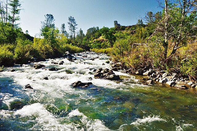
Putah Creek's natural flow above Lake Berryessa in the Mayacamas Mountains during September 2017

The source of Putah Creek on Cobb Mountain
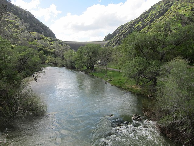
A view of Putah Creek from Highway 128 bridge, below Monticello Dam
Yolo Bypass
Videos
Page
The Yolo Bypass is one of the two flood bypasses in California's Sacramento Valley located in Yolo and Solano Counties. Through a system of weirs, the bypass diverts floodwaters from the Sacramento River away from the state's capital city of Sacramento and other nearby riverside communities.
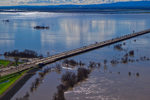
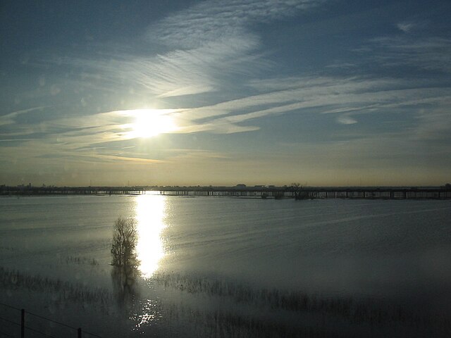
View of the flooded Yolo Bypass, looking southwest from West Sacramento (2017)

Fremont Weir (2010)
Flooded Yolo Bypass, February 2006. Interstate 80 runs along the causeway in the distance.
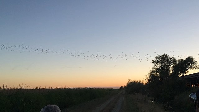
Approximately 250,000 Mexican free-tailed bats migrate to and nest under the Yolo Causeway during the summer (2018)