River Fal
Videos
Page
The River Fal flows through Cornwall, rising at Pentevale on Goss Moor and reaching the English Channel at Falmouth. On or near the banks of the Fal are the castles of Pendennis and St Mawes as well as Trelissick Garden. The River Fal separates the Roseland peninsula from the rest of Cornwall. Like most of its kind on the south coast of Cornwall and Devon, the Fal estuary is a classic ria, or drowned river valley. The Fal estuary from Tregony to the Truro River was originally called Hafaraell.
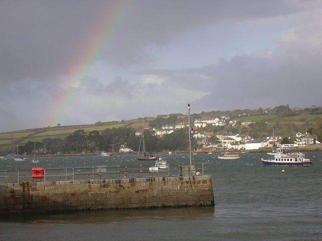
Flushing, from Fish Strand Quay, Falmouth, with rainbow

The River Fal at Devoran

River Fal and cathedral at Truro
Cornwall
Videos
Page
Cornwall is a ceremonial county in South West England. It is recognised by Cornish and Celtic political groups as one of the Celtic nations, and is the homeland of the Cornish people. The county is bordered by the Atlantic Ocean to the north and west, Devon to the east, and the English Channel to the south. The largest settlement is Falmouth, and the county town is the city of Truro.

Image: The stamps and whim engine house at Wheal Coates geograph.org.uk 1476958

Image: St Michael's Mount View

Image: A walk on Bodmin Moor, Cornwall (3), 30 Sept. 2010 Flickr Phillip C
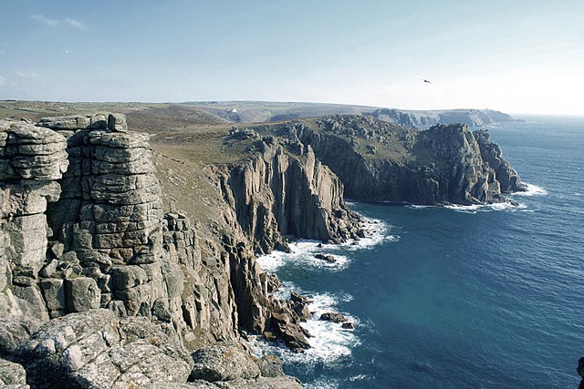
Cliffs at Land's End